available


€985.00 Tax included
error
Shipped according to supplier's deadline
-
Livraison à domicile : Gratuit
Une question ?
+33 2 97 11 80 95
In the same category
4 other products seleted for you-
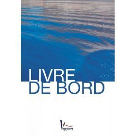
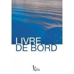
<h2>The indispensable logbook</h2>
<p><span>A practical board book at a low price!</span></p>
<h2>Characteristics of the manual: Vagnon logbook</h2>
available

-
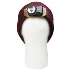
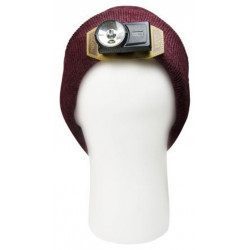
<h2>The Coal Lamp cap, a genius idea!</h2>
<p>No need to choose between having warm ears and having a light well directed to where you look! The Coal Lamp cap is the real good idea: Its integrated headlamp is rechargeable, offers a power of 100 lumens, and a 200 hours autonomy. The lamp is tiltable to adapt and direct the light to your needs. It even has a red light mode, and is removable if you want to use the cap without lighting.</p>
<p>The cap is one size fits all!</p>
<h2>Features of the Coal Lamp beanie</h2>
unavailable
-
<div class="fiche-txt">
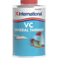
<h2>VC General Thinner from International</h2>
<div class="fiche-txt">This thinner has been specially formulated for use with the International VC range of products.</div>
<div class="fiche-txt"></div>
<h2>Features of the VC General Thinner from International</h2>
</div>
unavailable
-
<div class="fiche-txt">
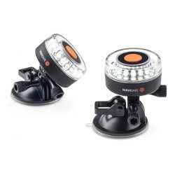
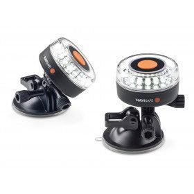
<h2>NaviSafe 360° navigation light with suction cup attachment</h2>
<div class="fiche-txt">This navigation light combines two successful NaviSafe products: the Navi 360° light and the suction cup. It will be perfect for safe navigation. It can be mounted on all types of smooth and flat surfaces. Its suction cup allows it to be fixed very quickly on a support. A self-adhesive is provided to securely attach the light to abrasive surfaces. This navigation light can be used on a mechanically propelled vessel from 12 to 50 meters long as a Sternlight or a white light circle. For vessels less than 12 metres in length, it can be used as a masthead light, sternlight or white light circle.</div>
<div class="fiche-txt"></div>
<h2>Features of the NaviSafe 360° navigation light with suction cup attachment</h2>
</div>
available