available


Detailed features

Choose from the list below an unfolded nautical chart covering the major sailing areas of the world
These maps covering huge areas of navigation are frequently used as a decorative element or as a support to retrace a journey between continents. Choose in the list below the area you wish to explore by referring to the map number associated with the desired navigation area. Indicate the map number you have chosen in the comments of your order.
List of references for charts and areas covered:
| 5417 | North Atlantic Ocean and Boreal Seas |
| 6561 | Oblique conformal map of the North Atlantic Ocean. France-Antilles - Route du Rhum |
| 6808 | South Atlantic Ocean - Eastern part |
| 6809 | Indian Ocean , Southern part |
| 6815 | North Atlantic Ocean - Eastern part |
| 6835 | North Pacific Ocean - Eastern part |
| 6884 | Indian Ocean - Northern part. |
| 6964 | From Panama to Cape Horn (Câbo de Hornos) |
| 6977 | North Pacific Ocean - Northwestern Portion |
| 7021 | North Pacific Ocean - Southwestern Portion |
| 7023 | From San Francisco to Lima |
| 7043 | North Atlantic Ocean - Western part |
| 7044 | From Tierra del Fuego to Venezuela |
| 7166 | South Pacific Ocean - West Part |
| 7246 | French Polynesia |
| 7271 | Australasia and adjacent seas |
Consult the entire catalogue of SHOM charts on line by clicking HERE
You might also like 3 other products seleted for you
-
<div class="fiche-txt">
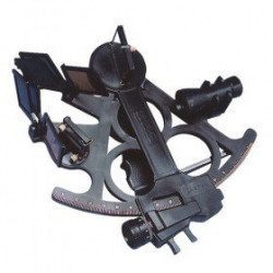
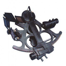
<h2>Sextant Davis Mark 15 from Topoplastic!</h2>
<p>This sextant is the reproduction of a real professional sextant. It is made of modern plastics, but it remains undeformable, shockproof and corrosion-proof. Light, robust and precise, this sextant is an indispensable navigation accessory. The Davis Mark 15 allows you to accurately determine all the points necessary for coastal and astronomical navigation.</p>
<h2>Detailed specifications of the Sextant Davis Mark 15 :</h2>
</div>
available

-
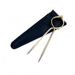
<h2>One Hand Brass Divider</h2>
<p style="text-align:justify;">One hand brass divider for aesthetics with fine stainless steel points for accuracy of measurement. The one hand divider is an indispensable marine instrument for measuring distances on a nautical chart whatever the scale, for determining its position in latitude and longitude or for positioning a point on the chart.</p>
<h2><span>Features of the One Hand Divider</span></h2>
available
-
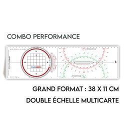
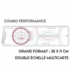
<h2>All the possibilities of the Cras rule and the Rappporteur Breton</h2>
<p style="text-align:justify;"><span>The Antares protractor ruler is both a tricolour Cras ruler AND a Breton protractor. It can be easily adapted to any skipper or sailor, whatever his or her initial training or practice habits. </span></p>
<h2>Features of the Antares rule</h2>
available

In the same category
4 other products seleted for you-
<div class="fiche-txt">
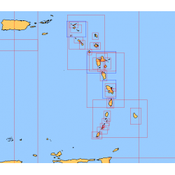
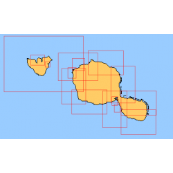
<h2>Choose from the list below an unfolded nautical chart of the sailing areas around Tahiti and the Society Islands</h2>
<p>This set of charts covers the whole of the Society Islands in unfolded Shom marine charts delivered in a tube. These charts detail the exact navigation areas of the islands. Choose from the list below the area you wish to explore by referring to the chart number associated with the desired navigation area. Indicate the map number you have chosen in the comments of your order.</p>
<h2>List of chart references and areas covered:</h2>
</div>
available
-
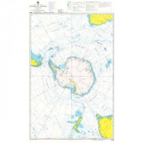
<h2 style="text-align:justify;">Admiralty Marine Map of the Antarctic Region</h2>
<p style="text-align:justify;">One of the only nautical chart references including the entire Antarctic. It will appeal to Vendée Globe fans who will be able to follow their favourite candidates around the Antarctic continent with a gnomonic projection instead of the classic Mercator projection which cannot be used in latitudes above 70° N or S.</p>
<h2 style="text-align:justify;">Characteristics of the Admiralty map of Antarctica</h2>
available

-
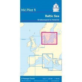
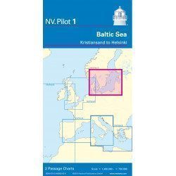
<h2>Baltic Sea Offshore Marine Chart</h2>
<p>The NV Pilot 1 offshore chart covers the Baltic Sea area from Kiel to Oslo on the front and the area from Skagerak (Flekkefjord) to Helsinki on the back.</p>
<h2>Details on the NV Pilot 1 - Baltic Sea map</h2>
available
-
<div class="fiche-txt">
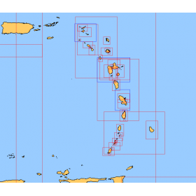
<h2>Choose from the list below a chart covering the sailing areas around the Caribbean Arc and the Caribbean Sea</h2>
<p>This set of charts covers all the sailing areas from Venezuela to Cuba, including all the islands of the Caribbean Arc. These Shom marine charts type L are more adapted to the yachtsman because they are folded in A4 format, easier to store in a yachting chart table. These charts detail precisely the sailing areas of the surrounding islands of the West Indies. Choose from the list below the area you wish to explore by referring to the chart number associated with the desired sailing area. Indicate the map number you have chosen and whether you want to sail flat or folded.</p>
<h2>List of chart references and areas covered:</h2>
</div>
available