Detailed features

Choose from the list below a chart covering the Mediterranean
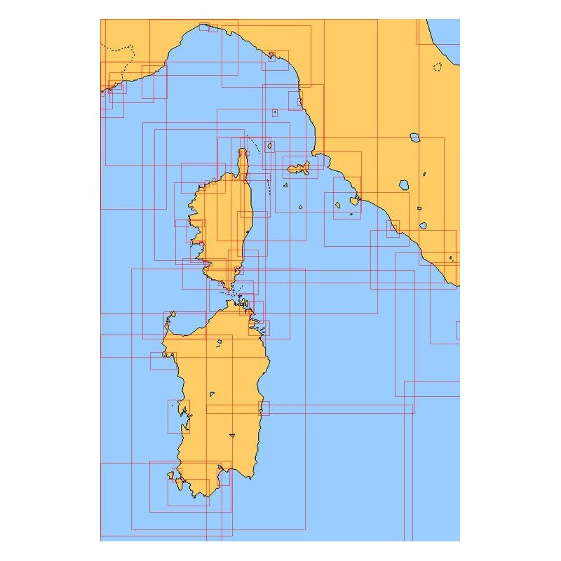
This set of charts covers all the navigation areas in the Mediterranean, with different scales allowing to cover either a large navigation area or to zoom in on a specific port or area. These Shom Marine charts are available in flat or folded format. The L type charts are more suitable for the yachtsman as they are folded to A4 size, easier to store in a chart table. These charts detail the navigation zones of all the sailing areas around Corsica, Sardinia and Italy. Choose from the list below the area you wish to explore by referring to the map number associated with the desired navigation area. Indicate the map number you have chosen and whether you want to sail folded or flat.
List of chart references and areas covered
| 3405 | From Algiers to the Tunisian border |
| 3975 | Adriatic Sea - Northern part |
| 6713 | North-East coast of Corsica - Canal de Corse |
| 6804 | Surroundings of Cagliari |
| 6821 | West coast of Corsica - From Cap Corse to the Gulf of Ajaccio |
| 6822 | North of Bastia |
| 6823 | South of Bastia |
| 6834 | Approaches to Arbatax |
| 6850 | Saint-Florent,Centuri,Macinaggio |
| 6855 | From Alistro lighthouse to Solenzara |
| 6911 | Gulf of Porto-Vecchio |
| 6929 | Surroundings of Porto-Vecchio - From the Favone cove to the Lavezzi islands |
| 6942 | From Punta d'Orchina to Cap Muro - Ajaccio's surroundings |
| 6951 | From Fos-sur-Mer to Capo Mele |
| 6961 | Gulf of La Spezia |
| 6963 | From San Rossore to the Piombino Canal - Isole d'Elba, Capraia and Gorgona |
| 6969 | From Cap Corse to Punta di l'Acciolu - Gulf of Saint-Florent |
| 6970 | From Punta di l'Acciolu to Capo Cavallo |
| 6980 | Ile Rousse - Sant'Ambrogio and Calvi |
| 7018 | From Portofino to San Rossore |
| 7019 | From Imperia to Portofino |
| 7024 | Mouths of Bonifacio |
| 7025 | Corsica Island |
| 7050 | From Calvi to Cargèse |
| 7096 | Bay of Figari - Port of Bonifacio |
| 7109 | Golfo di Oristano |
| 7162 | From Cape Muro to Cape Feno |
| 7175 | From Elba Island to Promontorio Argentario |
| 7176 | Portoferraio Harbour |
| 7177 | Elba Island |
| 7178 | From the mouth of the Ombrone to Promontorio Argentario |
| 7189 | Olbia and Aranci Gulfs - Tavolara and Molara Islands |
| 7190 | Gulf of Congianus - From Capo Ferro to Capo Figari |
| 7191 | Maddalena Archipelago |
| 7192 | From Promontorio Argentario to Capo Linaro |
| 7200 | From Cap d'Antibes to Cap Ferrat - Baie des Anges - Rade de Villefranche |
| 7202 | From Capo Linaro to Anzio |
| 7204 | From Marseille to Elba Island (Isola d'Elba) and the Bouches de Bonifacio |
| 7229 | From Nice to Piombino |
| 7244 | From Porto Corsini to Velebitski Kanal - Gulf of Venice |
| 7280 | Gulf of Ajaccio |
| 7287 | Isole Pontine |
| 7290 | Port of Genova - Eastern part |
| 7291 | From Piombino to Fiumicino and East coast of Corsica |
| 7316 | Gulf of Sagone |
| 7332 | From Isola San Pietro to Cagliari |
| 7335 | Gulf of Palmas |
| 7362 | From Capo Circeo to Ischia - Isole Pontine |
| 7366 | From Anzio to Capo Circeo - Isole Pontine |
| 7409 | From the Rade d'Agay to Monaco |
| 7441 | Approaches and Ports of Monaco - From Cap d'Ail to Cap Martin |
| 7442 | From Villefranche-sur-Mer to Menton |
| 7443 | From Cap Ferrat to Capo San Lorenzo |
| 7506 | Port of Genova - Western part |
| 7507 | From the Gulf of Lion to the Bouches de Bonifacio |
| 7508 | From Capo Caccia to Capo Sant'Elia |
| 7509 | From Capo Sant'Elia to Capo Bellavista |
| 7510 | From Capo Bellavista to the Bouches de Bonifacio |
| 7516 | Approaches and port of Livorno |
| 7530 | Approaches to Civitavecchia |
| 7534 | La Spezia Harbour |
| 7535 | Port of La Spezia |
| 7607 | Canale di San Pietro |
| 7771 | Alghero harbour and Port Conte |
| 7772 | Gulf of Asinara |
| 7773 | Islands of Capraia and Gorgona |
| 7774 | from Fiumicino to Punta Licosa |
| 7775 | From Cefalù to Trapani and Isole Ègadi |
| 7790 | Port of Civitavecchia |
Consult the entire catalogue of SHOM charts on line by clicking HERE
You might also like 4 other products seleted for you
-
<div class="fiche-txt">
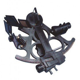
<h2>Sextant Davis Mark 15 from Topoplastic!</h2>
<p>This sextant is the reproduction of a real professional sextant. It is made of modern plastics, but it remains undeformable, shockproof and corrosion-proof. Light, robust and precise, this sextant is an indispensable navigation accessory. The Davis Mark 15 allows you to accurately determine all the points necessary for coastal and astronomical navigation.</p>
<h2>Detailed specifications of the Sextant Davis Mark 15 :</h2>
</div>
available

-
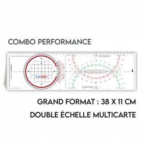
<h2>All the possibilities of the Cras rule and the Rappporteur Breton</h2>
<p style="text-align:justify;"><span>The Antares protractor ruler is both a tricolour Cras ruler AND a Breton protractor. It can be easily adapted to any skipper or sailor, whatever his or her initial training or practice habits. </span></p>
<h2>Features of the Antares rule</h2>
available

-
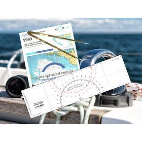
<h2><strong>The essential pack to prepare your offshore licence</strong></h2>
<p style="text-align:justify;">A set of quality tools to pass your offshore licence! Picksea is the owner of the Flash-Tide Instruments brand and our teams manufacture in France, in Lorient, all models of <a href="https://www.picksea.com/en/106806-cras-navigation-rules">rules cras</a> or Breton. Picksea is also a SHOM agent. We are therefore the best able to provide you with a pack composed of the best products at the best price.</p>
<h2>Composition of the offshore licence pack</h2>
available

-
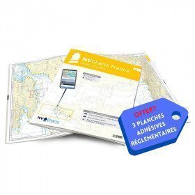
<h2>NV-CHARTS FR9 - 70 Mediterranean Sea charts (from Cap Creus to Toulon) + the 3 regulatory adhesive sheets</h2>
<p><span style="font-size:10pt;">In this NV-Charts FR9 pack, you will find an Atlas of <span>70 Mediterranean charts from Cap Creus to Toulon including 3 offshore charts, 14 coastal charts and 53 detailed charts</span>. With a personal download code, you will have access to all the maps in digital format as well as the <strong>NV Graphical Navigator light navigation software</strong> both freely usable on PC, tablets or smartphone!</span></p>
<p><span style="font-size:10pt;">The areas represented are: <strong>Mediterranean - Port Vendres, Leucate, Canet, Port La Nouvelle, Gruissan, Cap d'Agde, Palavas, Port Camargue, La Grande Motte, Martigue, Carry, Marseille, Calanques, Cassis, La Ciotat, Saint Cyr, Bandol, Toulon (FRANCE)</strong></span></p>
<p><span style="font-size:10pt;"><span style="color:#ff0000;"><strong>Free with your FR9 pack:</strong></span> 3 adhesive sheets containing the mandatory regulatory documentation (RIPAM, buoys and flags) for navigation in coastal areas (art 242-2.04 of Division 240). <span style="color:#ff0000;"><strong>When you buy your pack, you have all the regulatory documentation for sailing within 6 miles of a shelter.</strong></span></span></p>
<h2>Description of the FR9 card pack</h2>
available
In the same category
4 other products seleted for you-
<h2>Sea Cards Packs for the Mediterranean Area</h2>
<p>The nv-charts are characterized by fine contours and easy to distinguish colour graduations of the depth lines: turquoise for coral reefs, red for the 2-metre line and blue for the 5-metre zones. Presented in a practical and user-friendly format (A3 closed and A2 open), a thick plastic envelope protects the charts, making them easy to store. The importance of a good graphic representation of the topography when navigating the Mediterranean is essential.<br /><br />Well-marked rivers, towns and street maps all contribute to a clear overview of the islands' waterfront facilities. Red numbered waypoints with coordinates based on WGS 84 allow mariners to navigate with their GPS instruments. Heights and depths are shown in the internationally recognized metre format. Large-scale approaches and land contour markings simplify entry into anchorages.</p>
<h2><span style="color:#ff0000;">Picksea is Premium Reseller of NV-Charts</span></h2>
<h2>Features of NV-Charts Packs - Mediterranean Zone</h2>
available

-
<p class="t12px">Marine chart shom <span class="searchproduct-list-item-name">6767 </span>for navigations along the blue coast and in the roadstead of Marseille until the calanques<span class="t12px">. Nautical chart SHOM type Carte L folded in A4 format <span class="t12px">or flat</span> </span>, for pleasure boating. Up to date printing Scale <strong><strong>1 : 50 000</strong><br /></strong></p>
available
-
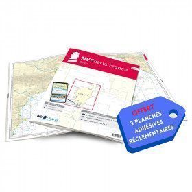
<h2>NV-CHARTS FR11 - 42 nautical charts of Corsica + the 3 regulatory adhesive boards</h2>
<p><span style="font-size:10pt;">In this NV-Charts FR11 pack, you will find an Atlas of <span>42 nautical charts of the whole of Corsica including 2 deep-sea charts, 19 coastal charts and 21 detailed charts</span>. With a personal download code, you will have access to all the maps in digital format as well as the <strong>NV Graphical Navigator light navigation software</strong> both freely usable on PC, tablets or smartphone!</span></p>
<p><span style="font-size:10pt;">The areas represented are: <strong>Corsica - Ajaccio, Calvi, Ile Rousse, Bastia, Porto Vecchio, Bonifacio, Lavezzi, Propriano (FRANCE)</strong></span></p>
<p><span style="font-size:10pt;"><span style="color:#ff0000;"><strong>Free with your FR11 pack:</strong></span> 3 adhesive sheets containing the mandatory regulatory documentation (RIPAM, buoys and flags) for navigation in coastal areas (art 242-2.04 of Division 240). <span style="color:#ff0000;"><strong>When you buy your pack, you have all the regulatory documentation for sailing within 6 miles of a shelter.</strong></span></span></p>
<h2>Description of the FR11 card pack</h2>
available
-
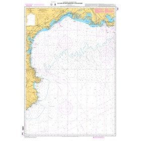
<p>Marine chart shom 7008. Cabo de San Sebastian to Fos sur Mer. Scale : 1:250000</p>
available


