Detailed features

Offshore Caribbean and East Coast of America Marine Chart
The NV Pilot 6 offshore chart covers: on the front, the Caribbean with the Bahamas, the Caribbean, the North Coast of South America, Panama, the East Coast of the USA and on the back, the East Coast of the USA from Nova Scotia to Florida and Bermuda.
NV Pilot 6 Map Details - Caribbean and Eastern Seaboard
The offshore chart NV Pilot 6 covers: on the front, the Caribbean with the Bahamas, the West Indies, the North coast of South America, Panama, the East coast of the United States and on the back, the East coast of the United States from Nova Scotia to Florida and Bermuda.
This range of charts has been published by NV-Charts in order to be able to plan a cruise or a crossing a range of charts under the name NV. Pilot.
These are double-sided folding paper maps with road maps at scales ranging from 1:1,150,000 to 1:750,000. These maps cover a large area and do not contain details.
All maps contain important traffic lights as well as distances between potential stopovers.
The cards are in A1 format and folded to 15 x 30 cm.
In the same category
4 other products seleted for you-
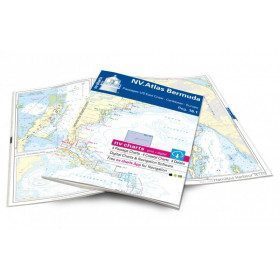
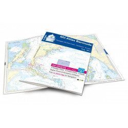
<h2>Atlas of Bermuda and Transatlantic charts return</h2>
<p style="text-align:justify;">Discover the pink beaches of Bermuda and prepare your transatlantic return with this atlas! Nautical charts for Bermuda and transatlantic sailing to Europe. 4 general charts, 4 coastal charts and 4 detailed charts are included. Size 30x42cm, bound in atlas form. In English language. The set includes a download code for all digital maps of the region. The digital maps can be used on our NV Charts app with a smartphone and tablet (Apple, iOS/MacOSX, Android, Windows 7/8).</p>
<h2 style="text-align:justify;">Features of the NV-Charts 16.1 Atlas</h2>
available

-
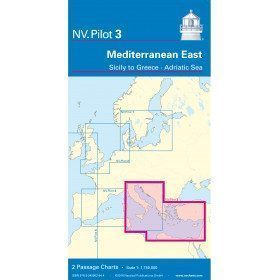
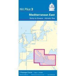
<h2>East Mediterranean Offshore Marine Chart</h2>
<p><span>The NV Pilot 3 offshore chart covers the Eastern Mediterranean: on the front side the Tyrrhenian Sea, the Adriatic Sea, the Ionian Sea and the region of Sicily up to the coast of Tunisia. The reverse side covers the Mediterranean Sea up to longitude 17°E</span></p>
<h2>Details on the NV Pilot 3 map - East Mediterranean</h2>
available
-
<p style="text-align:justify;">SHOM 7475L folded nautical chart. Centered on the Caribbean Arc area from Puerto Rico to Trinidad. Scale : 1:1000000</p>
available
-
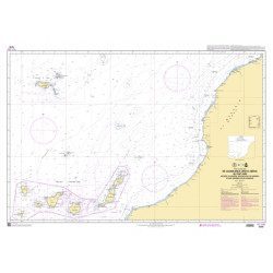
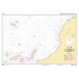
<p style="text-align:justify;">Marine chart shom 7270 for navigations between Casablanca and Cape Jubi, and in the Madeira and Canary Islands area. Ideal for the sailor who wishes to make a transatlantic crossing.</p>
available