available


Detailed features

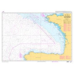
Baltic Sea Offshore Marine Chart
The NV Pilot 1 offshore chart covers the Baltic Sea area from Kiel to Oslo on the front and the area from Skagerak (Flekkefjord) to Helsinki on the back.
Details on the NV Pilot 1 - Baltic Sea map
The offshore chart NV Pilot 1 covers the Baltic Sea the area from Kiel to Oslo on the front and the area from Skagerak (Flekkefjord) to Helsinki on the back.
This range of charts has been published by NV-Charts in order to be able to plan a cruise or a crossing a range of charts under the name NV. Pilot.
These are double-sided folding paper maps with road maps at scales ranging from 1:1,150,000 to 1:750,000. These maps cover a large area and do not contain details.
All maps contain important traffic lights as well as distances between potential stopovers.
In the same category
4 other products seleted for you-
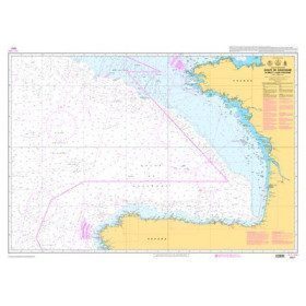
<p>Official SHOM chart - 7211 L - Bay of Biscay - from Brest to Cabo Finisterre.</p>
available

-
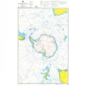
<h2 style="text-align:justify;">Admiralty Marine Map of the Antarctic Region</h2>
<p style="text-align:justify;">One of the only nautical chart references including the entire Antarctic. It will appeal to Vendée Globe fans who will be able to follow their favourite candidates around the Antarctic continent with a gnomonic projection instead of the classic Mercator projection which cannot be used in latitudes above 70° N or S.</p>
<h2 style="text-align:justify;">Characteristics of the Admiralty map of Antarctica</h2>
available

-
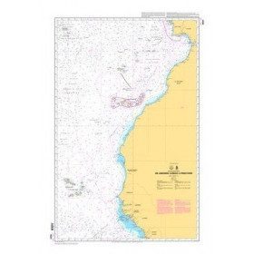
<p style="text-align:justify;">Shom 6624 nautical chart for sailing along the Portuguese and African coasts. Ideal for the sailor who wishes to make a transatlantic crossing.</p>
available
-
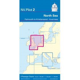
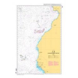
<h2>North Sea Offshore Marine Chart</h2>
<p><span>The NV Pilot 2 offshore chart covers the North Sea from Dover to Helgoland and Doggerbank in the North and the English Channel from Falmouth/Ushant to Dover on the front. On the reverse side, the area covers Great Yarmouth to Skagen, Inverness and the southern coast of Norway.</span></p>
<h2>Details on the NV Pilot 2 - North Sea map</h2>
available