available


Detailed features

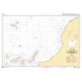
Shom 6624 nautical chart for sailing along the Portuguese and African coasts. Ideal for the sailor who wishes to make a transatlantic crossing.
SHOM chart number 6624L. in the Portugal and Africa region.
In the same category
4 other products seleted for you-
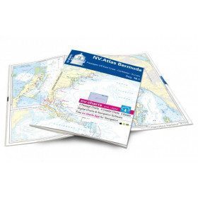
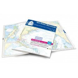
<h2>Atlas of Bermuda and Transatlantic charts return</h2>
<p style="text-align:justify;">Discover the pink beaches of Bermuda and prepare your transatlantic return with this atlas! Nautical charts for Bermuda and transatlantic sailing to Europe. 4 general charts, 4 coastal charts and 4 detailed charts are included. Size 30x42cm, bound in atlas form. In English language. The set includes a download code for all digital maps of the region. The digital maps can be used on our NV Charts app with a smartphone and tablet (Apple, iOS/MacOSX, Android, Windows 7/8).</p>
<h2 style="text-align:justify;">Features of the NV-Charts 16.1 Atlas</h2>
available

-
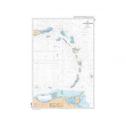
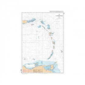
<p style="text-align:justify;">SHOM 7475L folded nautical chart. Centered on the Caribbean Arc area from Puerto Rico to Trinidad. Scale : 1:1000000</p>
available
-
<p style="text-align:justify;">Shom marine chart essential to make a perfect transatlantic by following the great circle.</p>
available
-
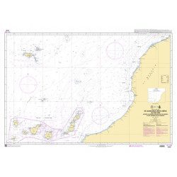
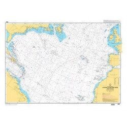
<p style="text-align:justify;">Marine chart shom 7270 for navigations between Casablanca and Cape Jubi, and in the Madeira and Canary Islands area. Ideal for the sailor who wishes to make a transatlantic crossing.</p>
available