available
")
")
")
Detailed features

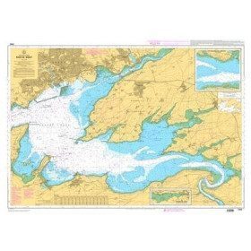
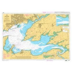
Marine chart for coastal navigation. SHOM 7310 L - Bay of Saint Brieuc (eastern part) - from Dahouët to Cap Fréhel. Scale 1:25000.
SHOM chart number 7310L. of the North Brittany region.
In the same category
4 other products seleted for you-
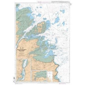
<p>Marine chart for coastal navigation. SHOM 7400 L - Rade de Brest - Scale 1:22500</p>
available

-
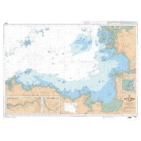
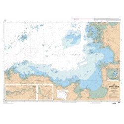
<p>Marine chart for coastal navigation. SHOM 7127 L - Bréhat Island - Paimpol Cove - Trieux Entrance. Scale 1:20000</p>
available
-
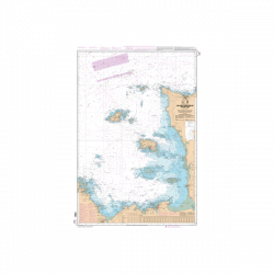
<p>Marine chart for coastal navigation. SHOM 7124 L - Bay of Lannion - from Pointe de Primel to Ile Grande - Scale 1:20000</p>
available
-
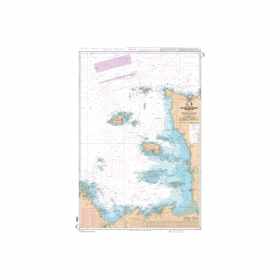
<p>Marine chart for coastal navigation. SHOM 6966L - Des Héaux-de-Bréhat au Cap Lévi - Shom paper chart - Scale : 1 : 155508</p>
available