available


Detailed features

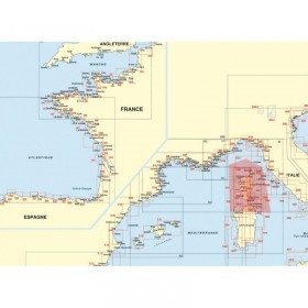
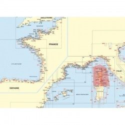
Shom marine chart 6821L. Nice to Piombino. Scale: 1:250000.
SHOM chart number 6821L. of the Mediterranean Sea region.
In the same category
4 other products seleted for you-
available

-
available
-
available
-
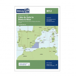
<h2>Imray Marine Chart M12 Cabo de Gata to Denia and Ibiza</h2>
<p>Plans included: Mar Menor (1:75 000) Torrevieja (1:20 000) Alicante (1:30 000) Villajoyosa (1:15 000) Altea (1:15 000) Dénia (1:25 000) Cartagena (1:15 000) This edition includes the latest official Instituto Hidrográfico de la Marina Digital, combined with additional information sourced from Imray's network to make it ideal for small craft. The chart has been fully revised throughout. The main panel has been rescaled to 1:450,000 for consistency with other M-Series charts in Mediterranean Spain. The plan of Mar Menor now provides coverage at an improved larger scale. A new plan of Cartagena has been added.</p>
<h2>Specifications of the Imray Marine Chart M12 Cabo de Gata to Denia and Ibiza</h2>
available