available


Detailed features

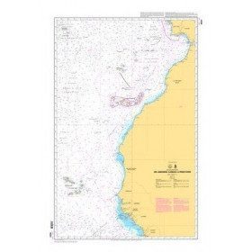
Official SHOM chart - 7211 L - Bay of Biscay - from Brest to Cabo Finisterre.
SHOM chart number 7211L. of the Atlantic crossing by Brittany.
In the same category
4 other products seleted for you-
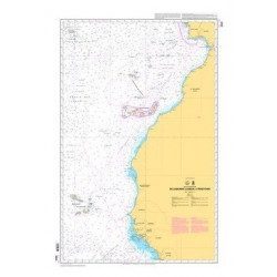
<p style="text-align:justify;">Shom 6624 nautical chart for sailing along the Portuguese and African coasts. Ideal for the sailor who wishes to make a transatlantic crossing.</p>
available

-
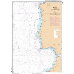
<p>Official SHOM chart - 7212 L - Cape Finisterre to Casablanca - Scale 1: 100000</p>
available
-
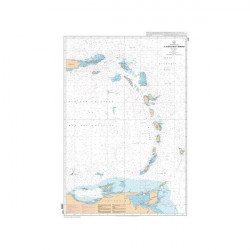
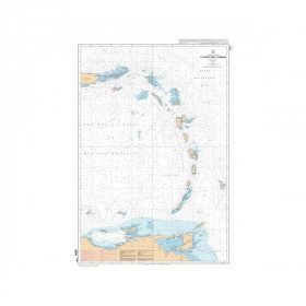
<p style="text-align:justify;">SHOM 7475L folded nautical chart. Centered on the Caribbean Arc area from Puerto Rico to Trinidad. Scale : 1:1000000</p>
available
-
<div class="fiche-txt">
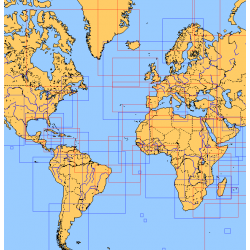
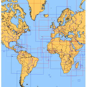
<h2>Choose from the list below an unfolded chart covering the sailing areas around the North and South Atlantic and the Indian Ocean</h2>
<p>These charts detail the sailing areas centered on the North and South Atlantic, the macro sailing areas of North and South America, Western Europe, Western Africa and the Indian Ocean. Delivered unfolded in a transport tube, these charts will serve as a support to trace your journey between continents. Choose from the list below the area you wish to explore by referring to the map number associated with the desired navigation area. Indicate the map number you have chosen in the comments of your order.</p>
<h2>List of chart references and areas covered:</h2>
</div>
available