available


Detailed features

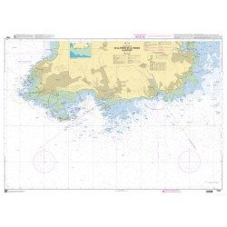
Nautical chart SHOM 7145L. From Triballe to Pornichet. Scale: 1:25000.
Card SHOM.
In the same category
4 other products seleted for you-
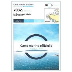
<p style="text-align:justify;">Marine map shom 7032 for your boat cruises. From Groix island and the outskirts of Lorient to Belle-Ile. Scale: 1:50000.</p>
available
-
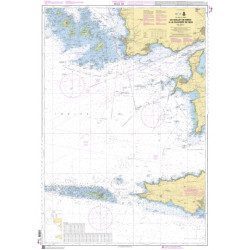
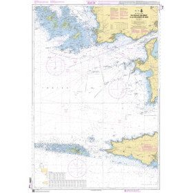
<h2>The SHOM marine chart 7148 L is the marine chart from the Goulet de Brest to the Chaussée de Sein.</h2>
<p>Area covered: Le Conquet, Molène, Goulet de Brest, Camaret, Ile de Sein, raz de Sein, Audierne. Scale 1:49,300.</p>
<h2>Characteristics of the SHOM 7148 L chart (folded version)</h2>
available
-
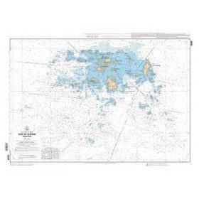
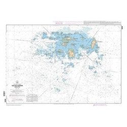
<p>SHOM marine chart 7252L. Les Glénans. Scale 1:20000</p>
available

-
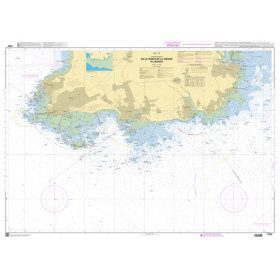
<h2>SHOM Marine Chart 7250L - From Pointe de la Torche to Loctudy</h2>
<ul><li>Scale 1:20000</li>
<li>Folded</li>
</ul>
available