available


Detailed features

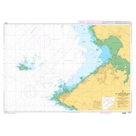
SHOM marine chart 7143 L. Approaches to the islands of Houat and Hoëdic. Scale 1:20000
SHOM chart.
In the same category
4 other products seleted for you-
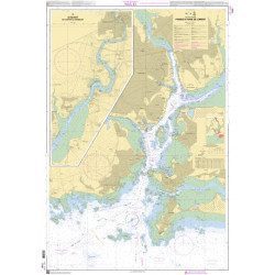
<p>SHOM marine chart 7140 L. Rade and passes of Lorient. Scale 1:10000</p>
available
-
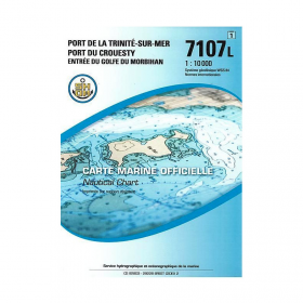
<p>SHOM marine chart 7107L : Harbour of la Trinité-Sur-Mer, harbour of Le Crouesty, entrée du Golfe du Morbihan. Scale 1:10000</p>
available
-
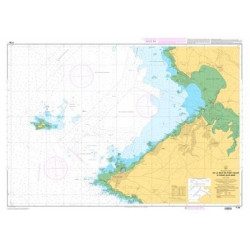
<p>Marine chart SHOM 7136L. From Mahé Bridge to Piriac sur Mer. Scale 1:15000.</p>
available
-
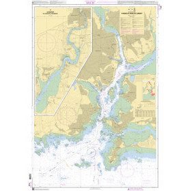
<p>SHOM marine chart 7139 L. Groix Island and Lorient roadstead. Scale 1:20000</p>
available