available


Detailed features

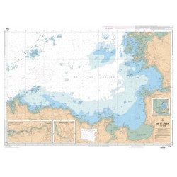
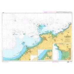
Marine chart for coastal navigation. SHOM 7129 L - from Cap Fréhel to Saint Briac-sur-Mer - Scale 1:20000.
SHOM chart number 7129L. of the North Brittany region.
In the same category
4 other products seleted for you-
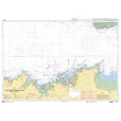
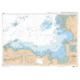
<h2>SHOM chart 7155L from Cap Fréhel to Pointe du Grouin and the approaches to Saint-Malo.</h2>
<p>Scale 1/48800.</p>
<p>Area covered: Cap Fréhel, Saint Cast, Lancieux, Approaches to Saint Malo, Dinard, Entrance to the Rance, Pointe du Grouin.</p>
available
-
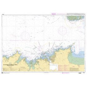
<h2>Marine charts 7126 L de l'Ile Balanec aux Heaux-de-Brehat : </h2>
<p>Scale 1:20 000 - Marine charts, SHOM : 7126L , from Ile Balanec to Heaux-de-Bréhat, and le cours du Jaudy.</p>
<h2>Features of marine charts 7126L : </h2>
available
-
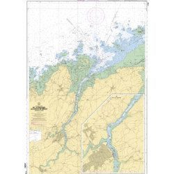
<p>Marine chart for coastal navigation. SHOM 7310 L - Bay of Saint Brieuc (eastern part) - from Dahouët to Cap Fréhel. Scale 1:25000.</p>
available
-
<p>Marine chart for coastal navigation. SHOM 7124 L - Bay of Lannion - from Pointe de Primel to Ile Grande - Scale 1:20000</p>
available