available


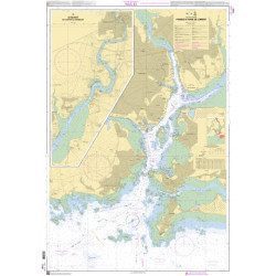
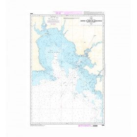
Marine chart 7107L : Harbour of La Trinité-Sur-Mer - Harbour of Le Crouesty - entrée du Golfe du Morbihan

€39.00 Tax included
error
Shipped within 10 days
Une question ?
+33 2 97 11 80 95
Detailed features
SHOM marine chart 7107L : Harbour of la Trinité-Sur-Mer, harbour of Le Crouesty, entrée du Golfe du Morbihan. Scale 1:10000
SHOM chart.
In the same category
4 other products seleted for you-
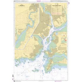
<p>SHOM marine chart 7140 L. Rade and passes of Lorient. Scale 1:10000</p>
available
-
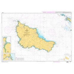
<p>SHOM marine chart 7142 L. Belle-Île. Scale 1:25000</p>
available

-
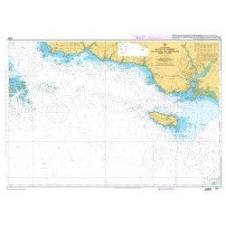
<p style="text-align:justify;">Shom marine chart for your cruises or regattas in Brittany. From Penfret island to the Birvideaux plateau via the outskirts of Lorient. Shom 7031. Scale: 1:50000.</p>
available
-
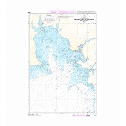
<p>SHOM marine chart 7251 L. From Loctudy to Concarneau. Scale 1:20 00.</p>
available