available


Detailed features

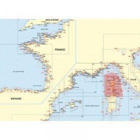
Marine chart shom 7008. Cabo de San Sebastian to Fos sur Mer. Scale : 1:250000
SHOM chart number 7008L. of the Mediterranean Sea region.
In the same category
4 other products seleted for you-
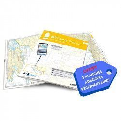
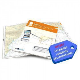
<h2>NV-CHARTS FR9 - 70 Mediterranean Sea charts (from Cap Creus to Toulon) + the 3 regulatory adhesive sheets</h2>
<p><span style="font-size:10pt;">In this NV-Charts FR9 pack, you will find an Atlas of <span>70 Mediterranean charts from Cap Creus to Toulon including 3 offshore charts, 14 coastal charts and 53 detailed charts</span>. With a personal download code, you will have access to all the maps in digital format as well as the <strong>NV Graphical Navigator light navigation software</strong> both freely usable on PC, tablets or smartphone!</span></p>
<p><span style="font-size:10pt;">The areas represented are: <strong>Mediterranean - Port Vendres, Leucate, Canet, Port La Nouvelle, Gruissan, Cap d'Agde, Palavas, Port Camargue, La Grande Motte, Martigue, Carry, Marseille, Calanques, Cassis, La Ciotat, Saint Cyr, Bandol, Toulon (FRANCE)</strong></span></p>
<p><span style="font-size:10pt;"><span style="color:#ff0000;"><strong>Free with your FR9 pack:</strong></span> 3 adhesive sheets containing the mandatory regulatory documentation (RIPAM, buoys and flags) for navigation in coastal areas (art 242-2.04 of Division 240). <span style="color:#ff0000;"><strong>When you buy your pack, you have all the regulatory documentation for sailing within 6 miles of a shelter.</strong></span></span></p>
<h2>Description of the FR9 card pack</h2>
available
-
available

-
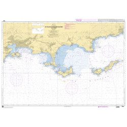
<h2>SHOM chart 7407 L is the nautical chart of Toulon Cavalaire sur Mer</h2>
<p>Area covered: Toulon, Saint Mandrier, Le Pradet, Port Cros, Porquerolles, Hyères, Le Lavandou. Scale 1/50200.</p>
<h2>Characteristics of the map 7407L (folded version) </h2>
available
-
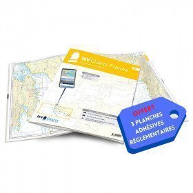
<h2>NV-CHARTS FR10 - 45 Côte d'Azur Nautical Charts (from Toulon to Menton) + the 3 regulatory adhesive boards</h2>
<p><span style="font-size:10pt;">In this NV-Charts FR10 pack, you will find an Atlas of <span>45 Mediterranean Riviera charts from Toulon to Menton and Monaco including 2 offshore charts, 11 coastal charts and 32 detailed charts.</span> With a personal download code, you will have access to all the maps in digital format as well as the <strong>NV Graphical Navigator light navigation software</strong> both freely usable on PC, tablets or smartphone!</span></p>
<p><span style="font-size:10pt;">The areas represented are: <strong>Mediterranean Riviera - Toulon, Hyères, Port Cros, Porquerolles, Fréjus, Saint Raphaël, Cannes, Antibes, Nice, Monaco, Menton (FRANCE).</strong></span></p>
<p><span style="font-size:10pt;"><span style="color:#ff0000;"><strong>Free with your FR10 pack:</strong></span> 3 adhesive sheets containing the mandatory regulatory documentation (RIPAM, buoys and flags) for navigation in coastal areas (art 242-2.04 of Division 240). <span style="color:#ff0000;"><strong>When you buy your pack, you have all the regulatory documentation for sailing within 6 miles of a shelter.</strong></span></span></p>
<h2>Description of the FR10 card pack</h2>
available