available


Detailed features

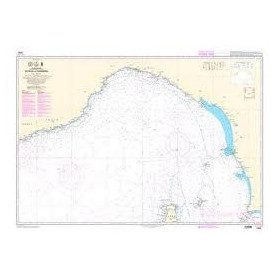
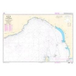
Mediterranean shom marine map : From Fos sur Mer to Capo Mele. Scale: 1:250000.
SHOM chart number 6951L. of the Mediterranean Sea region.
In the same category
4 other products seleted for you-
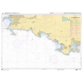
<h2>The SHOM 7406 L chart is the marine chart from Marseille to Toulon.</h2>
<p>Area covered: Marseille South, Cassis, Archipelago of Riou, La Ciotat, Bandol, Toulon. Scale 1/50000.</p>
<h2>Characteristics of the SHOM 7406L chart (folded version)</h2>
available
-
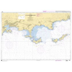
<p>Shom marine chart 6821L. Nice to Piombino. Scale: 1:250000.</p>
available

-
available
-
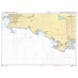
<h2>SHOM chart 7407 L is the nautical chart of Toulon Cavalaire sur Mer</h2>
<p>Area covered: Toulon, Saint Mandrier, Le Pradet, Port Cros, Porquerolles, Hyères, Le Lavandou. Scale 1/50200.</p>
<h2>Characteristics of the map 7407L (folded version) </h2>
available