available


€70.00 Tax included
error
Shipped within 5 days
-
Livraison en points relais : Gratuit
Une question ?
+33 2 97 11 80 95
Detailed features
Guide from the prestigious English publishing house IMRAY, world reference in the field of marine cartography. This guide covers the areas of Greece and the Aegean Sea, Athenes, Cyclades, Sporades, Chalkidiki, Dodecanesia. Edition of 23/04/2012
- 340 pages Format: 21 x 29,7 cm
- Edition of 23/04/2012
Download
-
Egee Sea - Mer Egee_en
In the same category
4 other products seleted for you-
available

-
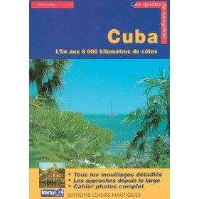
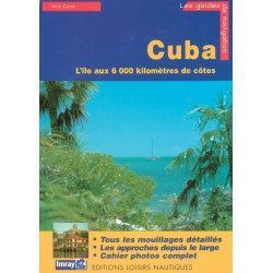
<p>Guide from the prestigious English publishing house IMRAY, a world reference in the field of marine cartography. This guide covers the Cuba areas. Edition of 01/01/2001</p>
available
-
<div class="fiche-txt">
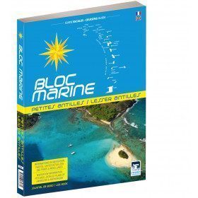
<h2>The Marine Block covering all the West Indies and updated</h2>
<p>The West Indies Marine block is the logbook for long distance cruising which allows you to have all the essential documents on board for a transatlantic navigation and once in the West Indies. The descriptions of the ports and the maps allow you to save precious time in order to discover these navigation areas in complete safety. Written in French and English, this guide covers an area from the Virgin Islands to Trinidad and Tobago.</p>
<h2>Detailed features of the Caribbean Marine Block</h2>
</div>
available

-
<h2>Vagnon's Pocket Guide to Seaweed and Seaside Plants</h2>
<p style="text-align:justify;"><strong>Observe and recognize 50 species of our coastline</strong>. As the seasons change, many seaweeds and plants are found along our coasts and seashores. The species presented in this guide are among the most common and easiest to observe. They are identified thanks to a precise portrait and essential information: habitat and geographical distribution, abundance, description, flowering and reproduction.</p>
<h2>Details on the Guide to Seaweed and Seaside Plants</h2>
available