Detailed features

Imray Characteristics of the Imray C42 map La Rochelle to Santander
Plans included:Lajes das Flores (1:20 000)Horta (1:12 500)Lajes do Pico (1:10 000)Velas (1:7500)Vila da Praia (1:10 000)Praia da Vitória (1:20 000)Angra do Heroísmo (1:12 500)Ponta Delgada (1:10 000)Vila Franco do Campo (1:15 000)Vila do Porto (1:10 000)Imray-Iolaire charts for the Atlantic Islands are widely acknowledged as the best available for the cruising sailor. They combine the latest official survey data with first-hand information gathered over 60 years of research by Don Street Jr and his wide network of contributors. Like all Imray charts, they are printed on water resistant Pretex paper for durability, and they include many anchorages, facilities and inlets not included on official charts.This edition includes the latest official data combined with additional information sourced from Imray''s network to make it ideal for small craft. It includes the latest official bathymetric surveys. Completed harbour works at Porto das Velas (São Jorge) is included and extra Marine Reserves are shown. For this edition magnetic variation curves have been added. There has been general updating throughout.
- Publisher Imray
- Edition date 2017
- Scale 1/350000 WGS84
- Printed and corrected in February 2021
- Map size 787 x 1118mm.
- Waterproof.
- Folded in a plastic pocket
In the same category
4 other products seleted for you-
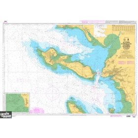
<p>Marine chart for navigations around the Ile de Ré. SHOM 7404 L - From the Pointe du Grouin du Cou to the Pointe de Chassiron</p>
available
-
available

-
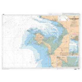
<p style="text-align:justify;">Shom 7394 marine chart for cruising around Noirmoutier. Scale: 1:50000.</p>
available
-
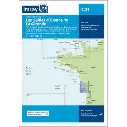
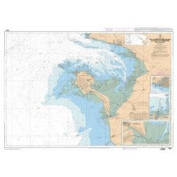
<h2 style="text-align:justify;">Imray C41 marine chart Sables d'Olonne to Gironde</h2>
<p style="text-align:justify;">In this edition, the latest depth readings have been applied where available. The development of ports and marinas at Port Minimes and La Pallice is included as well as the latest information on nature and marine reserves. The map of the Gironde at Bordeaux is more detailed and easier to use. The map specification has been improved to show coloured flashes of light. A general update has been made.</p>
<p style="text-align:justify;">Maps included:</p>
<ul><li>Bourgenay (1:10 000)</li>
<li>Approach to Jard-sur-Mer (1:17 500)</li>
<li>Approach to Ars-en-Ré (1:40 000)</li>
<li>Approach to St Martin-de-Ré (1:15 000)</li>
<li>Approach to La Flotte-en-Ré (1:15 000)</li>
<li>Rade de la Pallice (1:40 000)</li>
<li>La Rochelle and the Port des Minimes (1:15 000)</li>
<li>St-Denis-d'Oléron (1:10 000)</li>
<li>Douhet (1:7500)</li>
<li>Boyardville (1:10 000)</li>
<li>Rochefort (1:10 000)</li>
<li>Royan (1:7500)</li>
<li>Port Médoc (1:12 500)</li>
<li>The Gironde & The Garonne (1:200 000)</li>
<li>Continuation to Bordeaux (1:200 000)</li>
</ul><h2 style="text-align:justify;">Characteristics of the Imray C41 map from Sables d'Olonne to Gironde</h2>
unavailable