unavailable


Detailed features

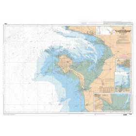
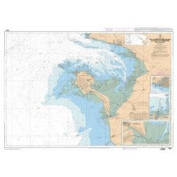
Imray C40 marine chart from Croisic to Sables d'Olonne
In this edition, the map specification has been improved to show coloured light flashes. The latest depth readings have been included where available and the shooting range has been updated. Additional tidal current data is included for Bourgneuf Bay. The plan of the L'Herbaudière marina has been revised to show its new configuration. A general update has been made throughout.
Plans included:
- Le Croisic (1:15 000)
- Saint-Nazaire (1:25 000)
- Pornic (1:12 500)
- L'Herbaudière (1:12 500)
- Goulet de Fromentine (1:30 000)
- Port-Joinville (Île d'Yeu) (1:10 500)
- Port de Saint-Gilles-Croix-de-Vie (1:15 000)
- Les Sables d'Olonne (1:20 000)
Characteristics of the Imray C40 map from Croisic to Sables d'Olonne
- Publisher Imray
- Edition date 2020
- Scale 1/110000 WGS84
- Printed and corrected in February 2021
- Map size 787 x 1118mm.
- Waterproof.
- Folded in a plastic sleeve
In the same category
4 other products seleted for you-
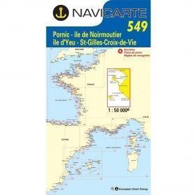
<p style="text-align:justify;">Shom 7394 marine chart for cruising around Noirmoutier. Scale: 1:50000.</p>
available

-
<p style="text-align:justify;">Shom 6990 marine chart for your navigations between Penmarc'h and the Gironde estuary. Scale: 1:355000</p>
available
-
available

-
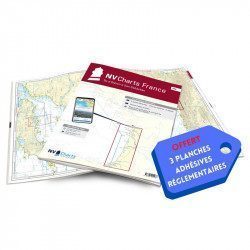
<h2>NV-CHARTS FR8 - 33 Aquitaine Marine Charts (from La Rochelle to San Sebastian) + the 3 regulatory adhesive sheets</h2>
<p><span style="font-size:10pt;">In this NV-Charts FR8 pack, you will find an Atlas of <span>33 Aquitaine charts from La Rochelle to San Sebastian including 3 offshore charts, 15 coastal charts and 15 detailed charts</span>. With a personal download code, you will have access to all the maps in digital format as well as the <strong>NV Graphical Navigator light navigation software</strong> both freely usable on PC, tablets or smartphone!</span></p>
<p><span style="font-size:10pt;">The areas represented are: <strong>Aquitaine - La Rochelle, Ré, Oléron, Rochefort, Royan, Gironde, Bordeaux, Arcachon, Bayonne, Biarritz, Saint Jean de Luz, San Sebastian (FRANCE)</strong></span></p>
<p><span style="font-size:10pt;"><span style="color:#ff0000;"><strong>Free with your FR8 pack:</strong> </span>3 adhesive sheets containing the mandatory regulatory documentation (RIPAM, buoys and flags) for navigation in coastal areas (art 242-2.04 of Division 240). <span style="color:#ff0000;"><strong>When you buy your pack, you have all the regulatory documentation for sailing within 6 miles of a shelter.</strong></span></span></p>
<h2>Description of the FR8 card pack</h2>
available