unavailable


€249.00 Tax included
clear
Please call us +33 297 11 80 95
-
Livraison à domicile : Gratuit
Une question ?
+33 2 97 11 80 95
Detailed features
Marine cartography on SD/MicroSD card compatible with all Garmin portable GPS with mapping. Local delimitation centred on South Brittany.
- Detailed navigation maps
- 2D or 3D flat display
- Navigation aids (wrecks, obstacles, regulated anchorages...)
- Customisable display of depth contours
- Port plans, intertidal zones
- Sounding points
- Tide stations (tide directory and charts)
- Detailed fishing maps
- Marine points of interest (marinas, harbours, boat ramps) Tide stations (tidal directory and graphics)
Download
-
Traceurs Garmin Compatibles - Liste des Traceurs Garmin Compatibles avec cette carte
In the same category
4 other products seleted for you-
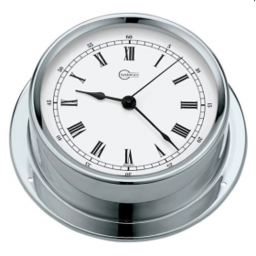
<div>
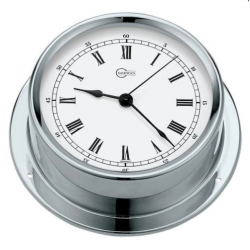
<h2>The REGATTA 100 mm diameter board watch from BARIGO</h2>
<div>This 100 mm diameter on-board watch will fit perfectly on your boat. It is part of the 100 REGATTA range from BARIGO which is exclusively made of polished stainless steel.</div>
<h2>The characteristics of the REGATTA 100 mm diameter edge watch from BARIGO</h2>
</div>
available

-
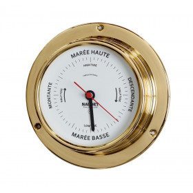
<div class="fiche-txt">
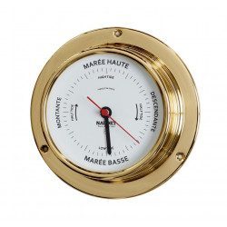
<h2>The NAUDET series 10 tide clock</h2>
This tide clock is available in chrome or brass. It has a collar, which will allow you to fix it on the wall. Its clockwork is set on the lunar day. The dial is engraved with a UV-resistant laser. You will have to adjust this clock according to the place where you will use it. In addition, to minimize the difference between the indicated value and the true tide time, it is recommended to make the adjustment on new moon days. <br /><h2>Characteristics of the NAUDET Series 10 Tide Clock</h2>
</div>
available
-
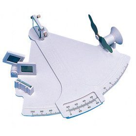
<div class="fiche-txt">
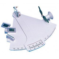
<h2>Davis Mark 3 Initiation Sextant</h2>
<p style="text-align:justify;">Small initiation sextant, made of non-deformable plastic materials. It allows to make a point with a reading of two minutes of arc. Very light, it is made of plastic with simple mechanical parts. This sextant has limited adjustment possibilities, but it will allow you to learn the main principles of astronomical navigation and to use it as an emergency sextant on board your boat.</p>
<h2>Detailed characteristics of the Davis Mark 3 Introductory Sextant:</h2>
</div>
available
-
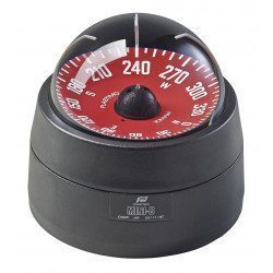
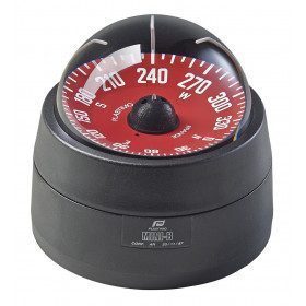
<div class="fiche-txt">
<h2>Compass suitable for light boats under 9m</h2>
<p>This compass is specially adapted for sailboats with its 3 alidades. No need to drill a hole to embed the compass, 3 screw holes are enough. The cell can be dismantled after each of your outings.</p>
<h2>Features of the Plastimo Mini-B Olympic Compass</h2>
</div>
available