available


Detailed features

Admiralty Marine Map of the Antarctic Region
One of the only nautical chart references including the entire Antarctic. It will appeal to Vendée Globe fans who will be able to follow their favourite candidates around the Antarctic continent with a gnomonic projection instead of the classic Mercator projection which cannot be used in latitudes above 70° N or S.
Characteristics of the Admiralty map of Antarctica
- ADMIRALTY Chart 4009: a flat map of the Antarctic region
- scale: 1:150000 published by ADMIRALTY, the United Kingdom Hydrographic Office.
- Edition: August-94.
- Size folded in 2: 71.5 x 53.5cm.
In the same category
4 other products seleted for you-
<div class="fiche-txt">
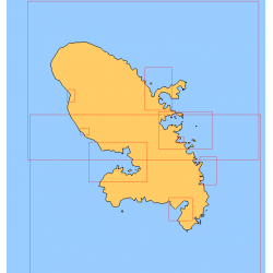
<h2>Choose in the list below a marine map of Martinique's surroundings</h2>
<p>This set of charts covers all the sailing areas of the island of Martinique in Shom marine charts of type L more adapted to the yachtsman because they are folded in A4 format, easier to store in a pleasure chart table. These maps detail precisely the navigation areas of the islands. Choose from the list below the area you wish to explore by referring to the chart number associated with the desired sailing area. Indicate the map number you have chosen in the comments of your order.</p>
<h2>List of chart references and areas covered:</h2>
</div>
available

-
<div class="fiche-txt">
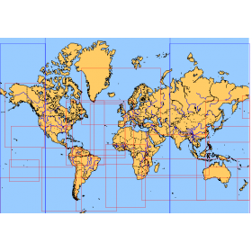
<h2>Choose from the list below an unfolded nautical chart covering the major sailing areas of the world</h2>
<p>These maps covering huge areas of navigation are frequently used as a decorative element or as a support to retrace a journey between continents. Choose in the list below the area you wish to explore by referring to the map number associated with the desired navigation area. Indicate the map number you have chosen in the comments of your order.</p>
<h2>List of references for charts and areas covered:</h2>
</div>
available
-
<div class="fiche-txt">
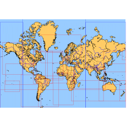
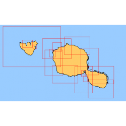
<h2>Choose from the list below an unfolded nautical chart of the sailing areas around Tahiti and the Society Islands</h2>
<p>This set of charts covers the whole of the Society Islands in unfolded Shom marine charts delivered in a tube. These charts detail the exact navigation areas of the islands. Choose from the list below the area you wish to explore by referring to the chart number associated with the desired navigation area. Indicate the map number you have chosen in the comments of your order.</p>
<h2>List of chart references and areas covered:</h2>
</div>
available
-
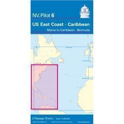
<h2>Offshore Caribbean and East Coast of America Marine Chart</h2>
<p style="text-align:justify;">The NV Pilot 6 offshore chart covers: on the front, the Caribbean with the Bahamas, the Caribbean, the North Coast of South America, Panama, the East Coast of the USA and on the back, the East Coast of the USA from Nova Scotia to Florida and Bermuda.</p>
<h2>NV Pilot 6 Map Details - Caribbean and Eastern Seaboard</h2>
available