available


In the same category
4 other products seleted for you-
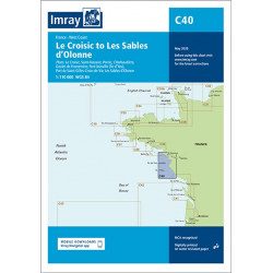
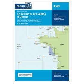
<h2 style="text-align:justify;">Imray C40 marine chart from Croisic to Sables d'Olonne</h2>
<p style="text-align:justify;">In this edition, the map specification has been improved to show coloured light flashes. The latest depth readings have been included where available and the shooting range has been updated. Additional tidal current data is included for Bourgneuf Bay. The plan of the L'Herbaudière marina has been revised to show its new configuration. A general update has been made throughout.</p>
<p style="text-align:justify;">Plans included:</p>
<ul><li>Le Croisic (1:15 000)</li>
<li>Saint-Nazaire (1:25 000)</li>
<li>Pornic (1:12 500)</li>
<li>L'Herbaudière (1:12 500)</li>
<li>Goulet de Fromentine (1:30 000)</li>
<li>Port-Joinville (Île d'Yeu) (1:10 500)</li>
<li>Port de Saint-Gilles-Croix-de-Vie (1:15 000)</li>
<li>Les Sables d'Olonne (1:20 000)</li>
</ul><h2 style="text-align:justify;">Characteristics of the Imray C40 map from Croisic to Sables d'Olonne</h2>
unavailable
-
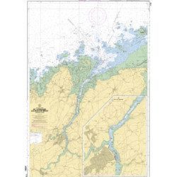
<h2>Marine charts 7126 L de l'Ile Balanec aux Heaux-de-Brehat : </h2>
<p>Scale 1:20 000 - Marine charts, SHOM : 7126L , from Ile Balanec to Heaux-de-Bréhat, and le cours du Jaudy.</p>
<h2>Features of marine charts 7126L : </h2>
available
-
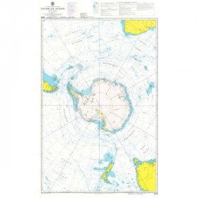
<h2 style="text-align:justify;">Admiralty Marine Map of the Antarctic Region</h2>
<p style="text-align:justify;">One of the only nautical chart references including the entire Antarctic. It will appeal to Vendée Globe fans who will be able to follow their favourite candidates around the Antarctic continent with a gnomonic projection instead of the classic Mercator projection which cannot be used in latitudes above 70° N or S.</p>
<h2 style="text-align:justify;">Characteristics of the Admiralty map of Antarctica</h2>
available


-
<p style="text-align:justify;">Shom marine chart essential to make a perfect transatlantic by following the great circle.</p>
available