available


Detailed features

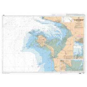
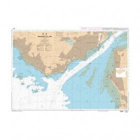
Marine map 7428L for your coasters and your discoveries of the Arcachon basin.
SHOM chart number 7428L. of the Atlantic coast, Arcachon basin.
In the same category
4 other products seleted for you-
<h2>NV-CHARTS FR8 - 33 Aquitaine Marine Charts (from La Rochelle to San Sebastian) + the 3 regulatory adhesive sheets</h2>
<p><span style="font-size:10pt;">In this NV-Charts FR8 pack, you will find an Atlas of <span>33 Aquitaine charts from La Rochelle to San Sebastian including 3 offshore charts, 15 coastal charts and 15 detailed charts</span>. With a personal download code, you will have access to all the maps in digital format as well as the <strong>NV Graphical Navigator light navigation software</strong> both freely usable on PC, tablets or smartphone!</span></p>
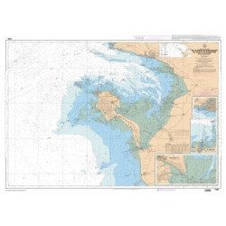
<p><span style="font-size:10pt;">The areas represented are: <strong>Aquitaine - La Rochelle, Ré, Oléron, Rochefort, Royan, Gironde, Bordeaux, Arcachon, Bayonne, Biarritz, Saint Jean de Luz, San Sebastian (FRANCE)</strong></span></p>
<p><span style="font-size:10pt;"><span style="color:#ff0000;"><strong>Free with your FR8 pack:</strong> </span>3 adhesive sheets containing the mandatory regulatory documentation (RIPAM, buoys and flags) for navigation in coastal areas (art 242-2.04 of Division 240). <span style="color:#ff0000;"><strong>When you buy your pack, you have all the regulatory documentation for sailing within 6 miles of a shelter.</strong></span></span></p>
<h2>Description of the FR8 card pack</h2>
available
-
<p style="text-align:justify;">Shom 7394 marine chart for cruising around Noirmoutier. Scale: 1:50000.</p>
available

-
<p>Nautical chart for navigations around the Ile de Ré. SHOM 7404 L - From Pointe du Grouin du Cou to Pointe de Chassiron</p>
available
-
<p style="text-align:justify;">SHOM marine chart 6797 for navigation in the mouth of the Loire up to the bridge of St Nazaire. SHOM marine chart type L folded to A4 format or flat, for pleasure boating. Up to date edition Scale: 1 : 15 000</p>
available