available


Detailed features

The practical guide to setting sail with your family!
A very complete illustrated guide which gives all the essential keys to succeed in this great adventure of leaving around the world, with your family, by boat.
Choice, preparation and equipment of the boat, logistics, the basics of life on board with children, psychological management, health, stopovers, etc... so many subjects to prepare before the big departure. An ideal guide to make the complete turn of the question, and to benefit as well as possible from this experience of life
- 271 pages
- Format : 24 cm X 19.5 cm
- Author: Gilles Ruffet
- Publication date: September 2021
In the same category
4 other products seleted for you-
<div class="fiche-txt">
<h2>How to choose your second-hand boat : Albert Brel</h2>
<p>The aim of this book by Albert BREL is to provide boaters with all the advice they need to acquire a second-hand boat, whether sailing or motor. The advice is given according to the budget and the sailing program.</p>
<p>In this manual, you will learn :</p>
<ul><li>To make the choice of<span>The boat's performance depends on the sailing program, the sailing areas, the parking mode and the hull.</span></li>
<li><span><span>Building materials.</span></span></li>
<li><span><span>To examine the vessel afloat</span></span></li>
<li><span><span>To do the dry dock examination</span></span></li>
<li><span><span>The purchase of the boat </span></span></li>
<li><span><span>Do-it-yourself repairs</span></span></li>
</ul><h2>Detailed characteristics of the Vagnon manual: Choosing your second-hand boat</h2>
</div>
available


-
<h2 style="text-align:justify;">Imray C41 marine chart Sables d'Olonne to Gironde</h2>
<p style="text-align:justify;">In this edition, the latest depth readings have been applied where available. The development of ports and marinas at Port Minimes and La Pallice is included as well as the latest information on nature and marine reserves. The map of the Gironde at Bordeaux is more detailed and easier to use. The map specification has been improved to show coloured flashes of light. A general update has been made.</p>
<p style="text-align:justify;">Maps included:</p>
<ul><li>Bourgenay (1:10 000)</li>
<li>Approach to Jard-sur-Mer (1:17 500)</li>
<li>Approach to Ars-en-Ré (1:40 000)</li>
<li>Approach to St Martin-de-Ré (1:15 000)</li>
<li>Approach to La Flotte-en-Ré (1:15 000)</li>
<li>Rade de la Pallice (1:40 000)</li>
<li>La Rochelle and the Port des Minimes (1:15 000)</li>
<li>St-Denis-d'Oléron (1:10 000)</li>
<li>Douhet (1:7500)</li>
<li>Boyardville (1:10 000)</li>
<li>Rochefort (1:10 000)</li>
<li>Royan (1:7500)</li>
<li>Port Médoc (1:12 500)</li>
<li>The Gironde & The Garonne (1:200 000)</li>
<li>Continuation to Bordeaux (1:200 000)</li>
</ul><h2 style="text-align:justify;">Characteristics of the Imray C41 map from Sables d'Olonne to Gironde</h2>
unavailable
-
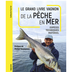
<h2>Make your sea fishing trips a success</h2>
<p><span>This manual is written by Guillaume Fourrier, holder of 19 fishing records. He explains to us <span>all the modern techniques of sea fishing, the necessary equipment and the assemblies through diagrams and photographs. </span></span></p>
<h2>Characteristics of the manual : The sea fishing guide</h2>
available
-
<div class="fiche-txt">
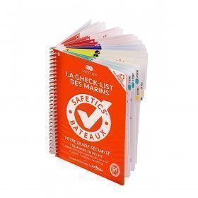
<h2>The Safetics safety guide New version: Sailboats and Motors</h2>
<p><span>All the<strong> good navigation practices</strong> are gathered in this book in the form of clear and easily accessible sheets for everyone. This waterproof guide is i</span><span>It is resistant to sea spray and tears, the guide <strong>SAFETICS</strong> is designed to be used in action and in the moment. It is filled with tips, emergency explanations, help and advice on how to use the<span>memories, of <strong>professional advice. </strong>You will quickly become dependent on this new companion.</span></span></p>
<p>This guide is the result of the work of enthusiasts who decided to create a simple and intuitive memo for pleasure boating. Its content is based on official recommendations, as well as on numerous feedbacks and experts' opinions, including in particular that of <strong>Armel Le Cléac'h </strong>a skipper and professional sailor. It has also been endorsed by the FFVoile, the SNSM, Météo France, the Gendarmerie Maritime, the French Navy and the Centre de Consultation Médicale Maritime. A real Sailor's Checklist for sailing and motor boats.</p>
<h2>Features of the Safetics Sailing Guide: Sailor's Checklist</h2>
</div>
available