available


Detailed features

Shom marine chart for your cruises or regattas in Brittany. From Penfret island to the Birvideaux plateau via the outskirts of Lorient. Shom 7031. Scale: 1:50000.
SHOM chart number 7031L. of the Brittany region.
In the same category
4 other products seleted for you-
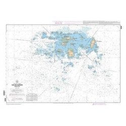
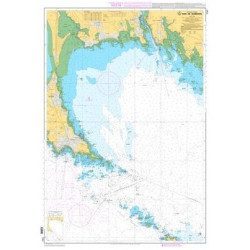
<p>SHOM marine chart 7141 L. Quiberon Bay. Scale 1:20000</p>
available

-
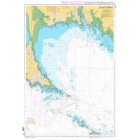
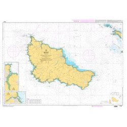
<p>SHOM marine chart 7142 L. Belle-Île. Scale 1:25000</p>
available
-
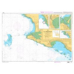
<p>Nautical chart SHOM 7145L. From Triballe to Pornichet. Scale: 1:25000.</p>
available
-
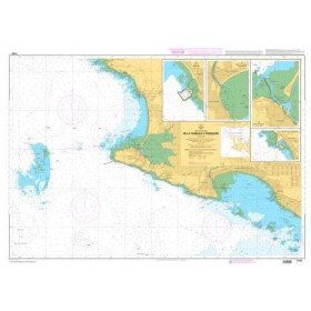
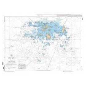
<p>SHOM marine chart 7252L. Les Glénans. Scale 1:20000</p>
available