Safety equipment
There are 218 products.
-
<div class="fiche-txt">
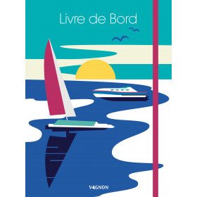
<h2>The logbook for your boat!</h2>
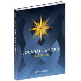
<p style="text-align:justify;">Here is the logbook / guestbook of the Bloc Marine brand, a luxury bound edition of 128 pages, printed in four-colour process on high quality paper. This logbook, which is compulsory on board for voyages beyond 6 miles from a shelter, is the essential element for noting and relating all the events of your navigation: safety, weather observations, route information, ship's conduct, positions and technical remarks, life on board. It also contains 12 pages of information and advice on navigation and weather.</p>
<p style="text-align:justify;">Its guest book allows you to keep all the memories of your navigations.</p>
<h2>Characteristic of the logbook of BLOC MARINE:</h2>
</div>
available
-
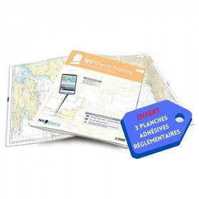
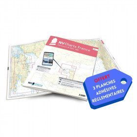
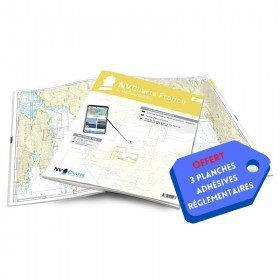
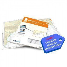
<h2>NV-CHARTS FR4 - 33 West Brittany Marine Charts (from the Seven Islands to Douarnenez) + the 3 regulatory adhesive sheets</h2>
<p><span style="font-size:10pt;">In this pack NV-Charts FR4, you will find an Atlas of 33 nautical charts from the Seven Islands to Douarnenez<span> including 2 offshore maps, 13 coastal maps and 18 detailed maps</span>. With a personal download code, you will have access to all the maps in digital format as well as the <strong>NV Graphical Navigator light navigation software</strong> both freely usable on PC, tablets or smartphone!</span></p>
<p><span style="font-size:10pt;">The areas represented are: <strong>Western Brittany - Roscoff, Morlaix, Ouessant, Molène, Brest, Camaret, Crozon, Morgat, Douarnenez, Sein (FRANCE).</strong></span></p>
<p><span style="font-size:10pt;"><span style="color:#ff0000;"><strong>Free with your FR4 pack:</strong></span> 3 adhesive sheets containing the mandatory regulatory documentation (RIPAM, buoys and flags) for navigation in coastal areas (art 242-2.04 of Division 240). <span style="color:#ff0000;"><strong>When you buy your pack, you have all the regulatory documentation for sailing within 6 miles of a shelter.</strong></span></span></p>
<h2>Description of the FR4 card pack</h2>
available
-
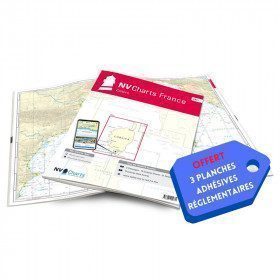
<h2>NV-CHARTS FR11 - 42 nautical charts of Corsica + the 3 regulatory adhesive boards</h2>
<p><span style="font-size:10pt;">In this NV-Charts FR11 pack, you will find an Atlas of <span>42 nautical charts of the whole of Corsica including 2 deep-sea charts, 19 coastal charts and 21 detailed charts</span>. With a personal download code, you will have access to all the maps in digital format as well as the <strong>NV Graphical Navigator light navigation software</strong> both freely usable on PC, tablets or smartphone!</span></p>
<p><span style="font-size:10pt;">The areas represented are: <strong>Corsica - Ajaccio, Calvi, Ile Rousse, Bastia, Porto Vecchio, Bonifacio, Lavezzi, Propriano (FRANCE)</strong></span></p>
<p><span style="font-size:10pt;"><span style="color:#ff0000;"><strong>Free with your FR11 pack:</strong></span> 3 adhesive sheets containing the mandatory regulatory documentation (RIPAM, buoys and flags) for navigation in coastal areas (art 242-2.04 of Division 240). <span style="color:#ff0000;"><strong>When you buy your pack, you have all the regulatory documentation for sailing within 6 miles of a shelter.</strong></span></span></p>
<h2>Description of the FR11 card pack</h2>
available
-
available

-
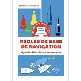
<h2>The indispensable logbook</h2>
<p><span>A practical board book at a low price!</span></p>
<h2>Characteristics of the manual: Vagnon logbook</h2>
available

-
<div class="fiche-txt"><h2>The indispensable tool for the Breton sailor: The Normandy Coastal Almanac 2019</h2><p style="text-align: justify;">A true bible or Swiss Army knife for professional and amateur sailors. The Normandy Coastal Almanac contains all the necessary and indispensable information for the smooth running of your trips in this region. This reference book is very complete since it contains information on many ports <span>of the English Channel as well as meteorological information such as tide times. Much more than a simple navigation guide, this almanac has for main objective to help the families of sailors in need.</span></p><h2>Detailed features of the Normandy coastal almanac</h2></div>
available
-
<h2>NV-CHARTS FR6 - 36 charts of South East Brittany (from Lorient to Noirmoutier) + the 3 regulatory adhesive sheets</h2>
<p><span style="font-size:10pt;">In this NV-Charts FR6 pack, you will find an Atlas of <span>36 charts of South Brittany from Lorient to Noirmoutier including 3 offshore charts, 13 coastal charts and 20 detailed charts</span>. With a personal download code, you will have access to all the maps in digital format as well as the <strong>NV Graphical Navigator light navigation software</strong> both freely usable on PC, tablets or smartphone!</span></p>
<p><span style="font-size:10pt;">The areas represented are: <strong>South Brittany - Lorient, Etel, Belle-Île, Baie de Quiberon, La Trinité, Golfe du Morbihan, Vannes, Auray, Houat, Hoedic, La Vilaine, Piriac, La Turballe, Le Croisic, La Baule, Pornichet, Saint Nazaire, Nantes, Pornic, Noirmoutier (FRANCE)</strong></span></p>
<p><strong><span style="font-size:10pt;"><span style="color:#ff0000;">Free with your FR6 pack:</span> 3 adhesive sheets containing the mandatory regulatory documentation (RIPAM, buoys and flags) for navigation in coastal areas (art 242-2.04 of Division 240). <span style="color:#ff0000;">When you buy your pack, you have all the regulatory documentation for sailing within 6 miles of a shelter.</span></span></strong></p>
<h2>Description of the FR6 card pack</h2>
available
-
<h2>NV-CHARTS FR7 - 27 Vendée Nautical Charts (from Noirmoutier to La Rochelle) + the 3 statutory adhesive sheets</h2>
<p><span style="font-size:10pt;">In this NV-Charts FR7 pack, you will find an Atlas of <span>27 charts Vendée from Noirmoutier to La Rochelle including 3 offshore charts, 12 coastal charts and 12 detailed charts.</span> With a personal download code, you will have access to all the maps in digital format as well as the <strong>NV Graphical Navigator light navigation software</strong> both freely usable on PC, tablets or smartphone!</span></p>
<p><span style="font-size:10pt;">The areas represented are: <strong>Vendée - Noirmoutier, Ile d'Yeu, Saint Gilles Croix de Vie, Les Sables d'Olonne, Port Bourgenais, Jard sur Mer, Pointe de l'Aiguillon, Ile de Ré, La Rochelle (FRANCE).</strong></span></p>
<p><span style="font-size:10pt;"><span style="color:#ff0000;"><strong>Free with your FR7 pack:</strong></span> 3 adhesive sheets containing the mandatory regulatory documentation (RIPAM, buoys and flags) for navigation in coastal areas (art 242-2.04 of Division 240). <span style="color:#ff0000;"><strong>When you buy your pack, you have all the regulatory documentation for sailing within 6 miles of a shelter.</strong></span></span></p>
<h2>Description of the FR7 card pack</h2>
available
-
available

-
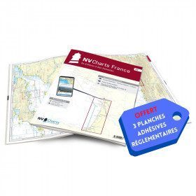
<h2>NV-CHARTS FR2 - 25 Western Channel Charts (from Cherbourg to St Malo) + the 3 regulatory adhesive sheets</h2>
<p><span style="font-size:10pt;">In this NV-Charts FR2 pack, you will find an atlas of 25 nautical charts from Cherbourg to St Malo, including 2 deep-sea charts, 14 coastal charts and 9 detailed charts. Thanks to a personal download code, you will have access to all the charts in digital format as well as to the <strong>NV Graphical Navigator light navigation software</strong> both freely usable on PC, tablets or smartphone!</span></p>
<p><span style="font-size:10pt;">The area represents the Channel (FRANCE), and more precisely the following areas: <strong>Channel Islands - Cherbourg, Granville, Chausey, Jersey, Guernsey, Cancale, Saint Malo.</strong></span></p>
<p><span style="font-size:10pt;"><span style="color:#ff0000;"><strong>Free with your FR2 pack:</strong></span> 3 adhesive sheets containing the mandatory regulatory documentation (RIPAM, buoys and flags) for navigation in coastal areas (art 242-2.04 of Division 240). <span style="color:#ff0000;"><strong>When you buy your pack, you have all the regulatory documentation for sailing within 6 miles of a shelter.</strong></span></span></p>
<h2>Description of the FR2 card pack</h2>
available
-
<div class="fiche-txt">
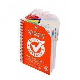
<h2>The Safetics safety guide New version: Sailboats and Motors</h2>
<p><span>All the<strong> good navigation practices</strong> are gathered in this book in the form of clear and easily accessible sheets for everyone. This waterproof guide is i</span><span>It is resistant to sea spray and tears, the guide <strong>SAFETICS</strong> is designed to be used in action and in the moment. It is filled with tips, emergency explanations, help and advice on how to use the<span>memories, of <strong>professional advice. </strong>You will quickly become dependent on this new companion.</span></span></p>
<p>This guide is the result of the work of enthusiasts who decided to create a simple and intuitive memo for pleasure boating. Its content is based on official recommendations, as well as on numerous feedbacks and experts' opinions, including in particular that of <strong>Armel Le Cléac'h </strong>a skipper and professional sailor. It has also been endorsed by the FFVoile, the SNSM, Météo France, the Gendarmerie Maritime, the French Navy and the Centre de Consultation Médicale Maritime. A real Sailor's Checklist for sailing and motor boats.</p>
<h2>Features of the Safetics Sailing Guide: Sailor's Checklist</h2>
</div>
available

-
available

-
unavailable

-
available

-
available

-
available

-
available

-
<h2>NV-CHARTS FR3 - 28 North Brittany Nautical Charts (Saint Malo aux Sept Îles) + the 3 regulatory adhesive sheets</h2>
<p><span style="font-size:10pt;">In this pack NV-Charts FR3, you will find an Atlas of 28 marine maps of <span>Saint Malo aux Sept Îles </span>including 3 offshore charts, 10 coastal charts and 15 detailed charts. With a personal download code, you will have access to all the maps in digital format as well as the <strong>NV Graphical Navigator light navigation software</strong> both freely usable on PC, tablets or smartphone!</span></p>
<p><span style="font-size:10pt;">The area represents the Channel (FRANCE), and more precisely the following areas: <strong>North Brittany - Saint Malo, Saint Cast, Baie de Saint Brieuc, Paimpol, Saint Quay, Perros Guirec, Trébeurden.</strong></span></p>
<p><span><span style="font-size:10pt;"><span style="color:#ff0000;"><strong>Free with your FR3 pack:</strong></span> 3 adhesive sheets containing the mandatory regulatory documentation (RIPAM, buoys and flags) for navigation in coastal areas (art 242-2.04 of Division 240). </span><span style="color:#ff0000;"><strong><span style="font-size:10pt;">When you buy your pack, you have all the regulatory documentation for sailing within 6 miles of a shelter</span>.</strong></span></span></p>
<h2>Description of the FR3 card pack</h2>
available
-
<h2>NV-CHARTS FR8 - 33 Aquitaine Marine Charts (from La Rochelle to San Sebastian) + the 3 regulatory adhesive sheets</h2>
<p><span style="font-size:10pt;">In this NV-Charts FR8 pack, you will find an Atlas of <span>33 Aquitaine charts from La Rochelle to San Sebastian including 3 offshore charts, 15 coastal charts and 15 detailed charts</span>. With a personal download code, you will have access to all the maps in digital format as well as the <strong>NV Graphical Navigator light navigation software</strong> both freely usable on PC, tablets or smartphone!</span></p>
<p><span style="font-size:10pt;">The areas represented are: <strong>Aquitaine - La Rochelle, Ré, Oléron, Rochefort, Royan, Gironde, Bordeaux, Arcachon, Bayonne, Biarritz, Saint Jean de Luz, San Sebastian (FRANCE)</strong></span></p>
<p><span style="font-size:10pt;"><span style="color:#ff0000;"><strong>Free with your FR8 pack:</strong> </span>3 adhesive sheets containing the mandatory regulatory documentation (RIPAM, buoys and flags) for navigation in coastal areas (art 242-2.04 of Division 240). <span style="color:#ff0000;"><strong>When you buy your pack, you have all the regulatory documentation for sailing within 6 miles of a shelter.</strong></span></span></p>
<h2>Description of the FR8 card pack</h2>
available
-
<div class="fiche-txt">
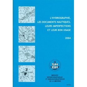
<h2>All the good uses of nautical documents in a dedicated book</h2>
<p>This book will give you a complete overview of hydrography and nautical records with their imperfections and proper use.</p>
<h2>All Shom's regulatory books on Picksea.com</h2>
You can find on our site all the regulatory works of the Shom, such as the International Regulations for Preventing Collisions at Sea 2A and 2B, or the work 3C on maritime signalling.</div>
available

-
<h2>NV-CHARTS FR5 - 29 South West Brittany nautical charts (from Douarnenez to Lorient) + the 3 statutory adhesive sheets</h2>
<p><span style="font-size:10pt;">In this NV-Charts FR5 pack, you will find an Atlas of <span>29 charts of South-West Brittany, from Douarnenez to Lorient, including 2 deep-sea charts, 11 coastal charts and 16 detailed charts</span>. With a personal download code, you will have access to all the maps in digital format as well as the <strong>NV Graphical Navigator light navigation software</strong> both freely usable on PC, tablets or smartphone!</span></p>
<p><span style="font-size:10pt;">The areas represented are: <strong>South West Brittany Douarnenez, Sein, Audierne, Guilvinec, Loctudy, Bénodet, Port La Forêt, Concarneau, Les Glénan, Aven Belon, Doëlan, Groix, Lorient(FRANCE).</strong></span></p>
<p><span style="font-size:10pt;"><span style="color:#ff0000;"><strong>Free with your FR5 pack:</strong></span> 3 adhesive sheets containing the mandatory regulatory documentation (RIPAM, buoys and flags) for navigation in coastal areas (art 242-2.04 of Division 240). <span style="color:#ff0000;"><strong>When you buy your pack, you have all the regulatory documentation for sailing within 6 miles of a shelter.</strong></span></span></p>
<h2>Description of the FR5 card pack</h2>
available
-
<h2>NV-CHARTS FR1 - 48 Channel Charts (Oostende to Cherbourg) + the 3 regulatory adhesive sheets</h2>
<p style="text-align:justify;"><span style="font-size:10pt;">In this NV-Charts FR1 pack, you will find an Atlas of 48 nautical charts from Oostende to Cherbourg including 4 offshore charts, 15 coastal charts and 29 detailed charts. Thanks to a personal download code, you will have access to all the charts in digital format as well as to the <strong>NV Graphical Navigator light navigation software</strong> both freely usable on PC, tablets or smartphone!</span></p>
<p style="text-align:justify;"><span style="font-size:10pt;">The area represents the Channel (FRANCE), and more precisely the following areas: <strong>Normandy - Zeebrugge, Dunkirk, Calais, Le Havre, Cherbourg.</strong></span></p>
<p style="text-align:justify;"><span style="font-size:10pt;"><span style="color:#ff0000;background-color:#ffffff;"><strong>Free with your FR1 pack:</strong></span> 3 adhesive sheets containing the mandatory regulatory documentation (RIPAM, buoys and flags) for navigation in coastal areas (art 242-2.04 of Division 240). <span style="color:#ff0000;"><strong>When you buy your pack, you have all the regulatory documentation for sailing within 6 miles of a shelter.</strong></span></span></p>
<h2>Description of the FR1 card pack</h2>
available
-
<h2>Logbook to write everything down!</h2>
<p><span>This premium version logbook <strong>Vagnon</strong> includes a cardboard cover with elastic band and a pocket to store your documents. It also contains a textbook, pages of notes and drawings as well as a lot of practical information (useful addresses, signals, rules of the road and helm, VHF, rescue and emergencies, RIPAM, etc.).</span></p>
<h2>Characteristics of the Vagnon logbook premium version</h2>
available

-
<h2>NV-CHARTS FR9 - 70 Mediterranean Sea charts (from Cap Creus to Toulon) + the 3 regulatory adhesive sheets</h2>
<p><span style="font-size:10pt;">In this NV-Charts FR9 pack, you will find an Atlas of <span>70 Mediterranean charts from Cap Creus to Toulon including 3 offshore charts, 14 coastal charts and 53 detailed charts</span>. With a personal download code, you will have access to all the maps in digital format as well as the <strong>NV Graphical Navigator light navigation software</strong> both freely usable on PC, tablets or smartphone!</span></p>
<p><span style="font-size:10pt;">The areas represented are: <strong>Mediterranean - Port Vendres, Leucate, Canet, Port La Nouvelle, Gruissan, Cap d'Agde, Palavas, Port Camargue, La Grande Motte, Martigue, Carry, Marseille, Calanques, Cassis, La Ciotat, Saint Cyr, Bandol, Toulon (FRANCE)</strong></span></p>
<p><span style="font-size:10pt;"><span style="color:#ff0000;"><strong>Free with your FR9 pack:</strong></span> 3 adhesive sheets containing the mandatory regulatory documentation (RIPAM, buoys and flags) for navigation in coastal areas (art 242-2.04 of Division 240). <span style="color:#ff0000;"><strong>When you buy your pack, you have all the regulatory documentation for sailing within 6 miles of a shelter.</strong></span></span></p>
<h2>Description of the FR9 card pack</h2>
available
-
<h2>NV-CHARTS FR10 - 45 Côte d'Azur Nautical Charts (from Toulon to Menton) + the 3 regulatory adhesive boards</h2>
<p><span style="font-size:10pt;">In this NV-Charts FR10 pack, you will find an Atlas of <span>45 Mediterranean Riviera charts from Toulon to Menton and Monaco including 2 offshore charts, 11 coastal charts and 32 detailed charts.</span> With a personal download code, you will have access to all the maps in digital format as well as the <strong>NV Graphical Navigator light navigation software</strong> both freely usable on PC, tablets or smartphone!</span></p>
<p><span style="font-size:10pt;">The areas represented are: <strong>Mediterranean Riviera - Toulon, Hyères, Port Cros, Porquerolles, Fréjus, Saint Raphaël, Cannes, Antibes, Nice, Monaco, Menton (FRANCE).</strong></span></p>
<p><span style="font-size:10pt;"><span style="color:#ff0000;"><strong>Free with your FR10 pack:</strong></span> 3 adhesive sheets containing the mandatory regulatory documentation (RIPAM, buoys and flags) for navigation in coastal areas (art 242-2.04 of Division 240). <span style="color:#ff0000;"><strong>When you buy your pack, you have all the regulatory documentation for sailing within 6 miles of a shelter.</strong></span></span></p>
<h2>Description of the FR10 card pack</h2>
available
-
<div class="fiche-txt">
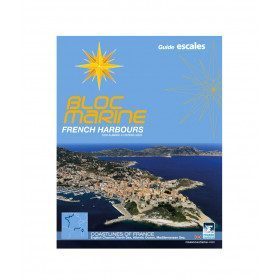
<h2>Marine Guide 100% English presentation of the French ports in the Channel, Atlantic and Mediterranean</h2>
<p>The French Harbours marine block is a complete guide in English published in 2013 presenting the French ports all along the Channel, Atlantic and Mediterranean coasts. This book contains all the mandatory and regulatory elements on board a boat, and offers you access to all the essential documents on board. Thus, browse the descriptions of the ports and have the maps updated. It allows you to save precious time to arrive at the port with peace of mind.</p>
<h2>Detailed summary of the Bloc Marine French Harbours</h2>
</div>
available

-
<div class="fiche-txt">
<h2>The Safetics safety guide english version : Sailboats and Motors</h2>
<p style="text-align:justify;">Safetics® The Sailor’s Checklist is the first English-language navigation guide written in the form of aviation-style check-lists. Recommended by Coast guards and translated and adapted by English skipper Pip Hare, it compiles all major navigation rules as well as procedures validated by sea safety experts. Its universal and practical content has been designed for both skippers and crew members, and is suitable for sailboats and powerboats. Its waterproof and tear proof format allows an unrivalled durability.</p>
<p style="text-align:justify;">This guide is the result of the work of enthusiasts who decided to create a simple and intuitive memo for pleasure boating. Its content is based on official recommendations, as well as on numerous feedbacks and experts' opinions, including in particular that of <strong>Armel Le Cléac'h </strong>a skipper and professional sailor. A real Sailor's Checklist for sailing and motor boats.</p>
<h2>Features of the Safetics Sailing Guide: Sailor's Checklist</h2>
</div>
available

-
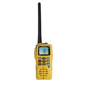
<h2>Navicom handheld VHF RT411+ 6W </h2>
<p>The Navicom RT411+ handheld VHF is the best selling portable VHF. It is very easy to use, compact, robust and reliable. It will accompany you in all your navigations! Waterproof IPX6 and floating, it has a battery life of about 12 hours. </p>
<h2><em>Reminder of the French regulations concerning the use of VHF</em></h2>
<p><em>A maritime radio station licence is mandatory, including for a portable VHF. It can be obtained free of charge from the Agence Nationale de Fréquences by logging on to the anfr.fr website</em></p>
<p><em>In French waters (waters bordering the French coastline up to 12 miles from the coast or the French river network), it is not necessary to have a maritime or river CRR (restricted radiotelephone operator certificate)</em></p>
<p><em>It is forbidden to use a VHF on land</em></p>
<h2>Technical features of VHF RT411+ Navicom</h2>
available

-
<div class="fiche-txt">
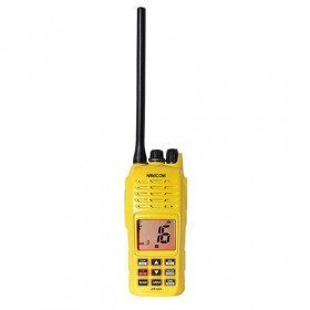
<h2>Navicom RT-420+ waterproof and floating VHF</h2>
<div class="fiche-txt">Light, compact, robust, easy to use, this VHF RT420+ meets your needs. With an autonomy of about 10 hours, it will be able to follow you without difficulty during your boat expeditions! With the FLASHLIGHT system, you will be able to find it if it is submerged thanks to a flashing light.</div>
<div class="fiche-txt"></div>
<h2>Features of the VHF RT 420+ Navicom</h2>
</div>
available

-
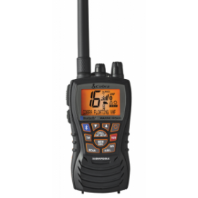
<p>This VHF is one of the most complete of the market. She is equipped with the wireless technology Bluetooth what allows you not to use your telephone. Furthermore she is tight but also floating in case of fall. Finally she possesses the " rewind say again " function which allows you to listen again to the last 20 seconds of your last communication.</p>
unavailable

-
<h2>Walkie Talkie for easy communication</h2>
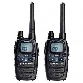
<p>High performance walkie talkie with a new, more modern design and the ability to boost transmit power. Better audio quality ensures that the G7 PRO communicates even more clearly. Very practical for communication on small bodies of water. Package content (blister pack of one pair) - 2 walkie talkies with clip - 2 NiMH 800mAh batteries - 1 double charger - 1 power supply</p>
<h2>Detailed features of the Midland G7 PRO Walkie Talkie</h2>
available

-
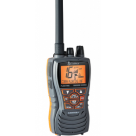
<p>This VHF is ideal for an intensive use. She has numerous properties which by way of her a very attractive VHF. She is floating, tight in the dumping furthermore she in a 6 watt power.</p>
unavailable

-
<div class="fiche-txt">
<h2>The RT750 Fixed VHF with GPS antenna</h2>
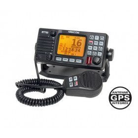
<div class="fiche-txt">It has a communication mode that uses a technique of automatic transmission of coded calls in digital format. The DSC (Digital Selective Calling) system will allow you to send a distress signal with a message that can be recognized within a radius of 30 to 50 miles by all boats equipped with a VHF DSC. The message will contain all the information needed by the rescue services to identify the affected boat and will be retransmitted from boat to boat until it is received by a rescue centre. This VHF RT750 also has an integrated GPS antenna.</div>
<div class="fiche-txt"></div>
<h2 class="fiche-txt"><span style="font-family:'novecento_wide_medium', sans-serif;font-size:16px;">Features of the Navicom RT750 Fixed VHF</span></h2>
</div>
available

-
<h2>RT411 Portable VHF PACK with charger, cable and headset</h2>
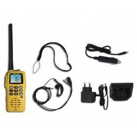
<p>The Navicom RT411 Portable VHF Pack comes with a 220V charger, USB charger and a headset. This VHF is very easy to use, compact, robust and reliable. Waterproof IPX6 and floating, it has a battery life of about 6 hours. It will accompany you in all your navigations!</p>
<h2>Features of the VHF RT411 Navicom pack</h2>
available

-
<h2>The VHF COBRA H 150 , waterproof and robust</h2>
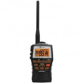
<p style="text-align:justify;">The Cobra H150 is a marine VHF, compact, floating and robust. Waterproof (IPX7), equipped with a backlit LCD screen and illuminated keypad it can be used in all weather conditions, or low light. This 3Watts radio offers excellent performance: its emission power of 05, 1, 3 watts will allow you to optimize its autonomy. It turns off automatically to save battery life. Lightweight and not bulky, it will easily find its place in a pocket of your jacket, or in a small box</p>
<h2>Features of the VHF COBRA H 150</h2>
available

-
<h2>HX 210 E marine VHF, 6 W, portable, waterproof and floating</h2>
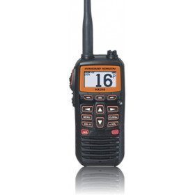
<p style="text-align:justify;">The VHF HX 210 E from Standard Horizon has a power of 1 to 6 W, and is waterproof (IPX 7: immersion 1 meter for 30 minutes) and floating. It has a function that allows it to start flashing immediately in contact with water. This light flash is adjustable in 3 modes: SOS, sparkling and fixed. ATIS function available, integrated FM radio. The transmission power is adjustable between 1,2,5 or 6 Watts. It has all international channels, and FM frequencies from 76 to 108 MHz. Its 1850 mAh Lithium-ion battery allows a long autonomy. This <a href="https://www.picksea.com/en/106682-portable-vhf">portable VHF</a> comes with a 12VDC and 220 VAC charging cable. LCD screen with backlight. Its new intuitive menu system allows access to all functions very easily. The extended receiver of the VHF HX 210 E allows you to synchronize your favorite FM station and receive and enjoy FM broadcasts.</p>
<h2>Features of the HX 210 E marine VHF</h2>
available

-
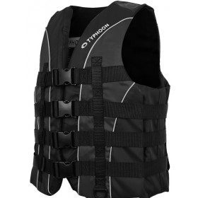
<h2>Chesil 50 newtons vest by Typhoon</h2>
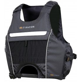
<p>50N buoyancy aid vest, specially designed by Typhoon for active, speed practices, such as dinghy, catamaran, kitesurf. The Chesil vest combines a short, ergonomic cut with an optimal design in terms of safety. Its wide armholes allow you to keep all your freedom of movement. Its soft, high-performance PVC foam and ripstop fabric make it comfortable and easy to wear throughout your water sports session. Its front opening is designed for trapeze belts or kite or surf harnesses.</p>
<h2>Characteristics of the Chesil 50 N vest</h2>
available

-
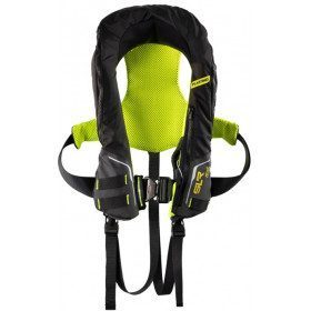
<h2>Automatic lifejacket SLR 196 with harness :</h2>
<p><span style="color:#58585a;font-family:Montserrat, sans-serif;font-size:14px;background-color:#ffffff;">Lightweight, comfortable, and high performance, the SLR 196 Newtons, with harness and double crutchstrap, has all the assets to be chosen by Sailors or the sailing elite.</span></p>
<h2><span style="color:#58585a;font-family:Montserrat, sans-serif;font-size:14px;background-color:#ffffff;">Caracteristics of the Automatic lSLR196 lifejacket :</span></h2>
available

-
<div class="fiche-txt">
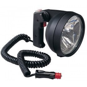
<h2>12V hand-held spotlight : </h2>
<p>This is a powerful handheld searchlight that could save your life. It contains 2 reflectors, 2 halogen bulbs activated by separate switches. It also has a morse code function that can be used with the on/off button.</p>
<h2>The characteristics of the 12V hand-held spotlight :</h2>
</div>
available

-
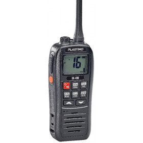
<h2>The SX-400 portable, waterproof and floating VHF</h2>
<p>Marine VHF, 5 watts, waterproof and floating, the SX-400 offers a 12-hour battery life, and excellent transmission and reception clarity. It also has an ATIS function for inland navigation. Its screen and keys are backlit, and recharging is done by USB cable. The VHF SX-400 comes with a cigarette lighter charger, wrist strap, USB cable and belt clip.</p>
<h2>Features of the VHF SX-400</h2>
available

-
<div class="fiche-txt">
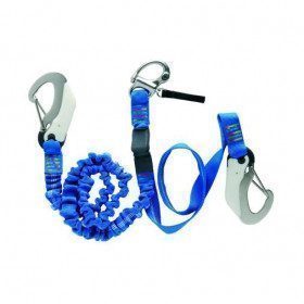
<h2>The Wichard Extendable Harness Lanyard with Manual Release Carabiner</h2>
<div class="fiche-txt">This backup is extendable from 1 to 2 m. There is an overload indicator. Compliant with the EN 1095 standard, it follows the OSR-ISAF recommendations.</div>
<div class="fiche-txt"></div>
<h2>Features of the Wichard Extendable Harness Backup with Manual Release Carabiner</h2>
</div>
available

-
<h2>Vest SOLVA 50N, from Typhoon, designed for ski, wakeboard, jet-ski</h2>
<p>The SOLVA 50N vest is specially designed by Plastimo and Typhoon for towed sports or jet-skiing. Its high impact resistance foam, its 4 buckles closure with adjustment, its ring to attach the circuit breaker, make it a practical, reliable vest, while remaining comfortable and easy to put on and take off. Its fabric is soft but very resistant. The Solva vest is the vest that offers excellent value for money, comfort, reliability and safety.</p>
<h2>Features of the SOLVA 50N Ski vest</h2>
available

-
<div class="pvc-description entry">
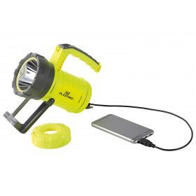
<h2>X-Spot floating spotlight</h2>
<p>The floating spotlight is extremely powerful with its 5 lighting modes. It has a 5000 mAh battery rechargeable by micro USB. It can also work with a CR 123 lithium battery. Finally, this X-Spot projector can be used as an external battery to connect a smartphone or any other USB rechargeable element.</p>
</div>
<div class="pvc-frame entry">
<h2>Features of the floating projector X-Spot</h2>
</div>
available

-
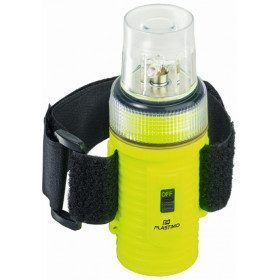
<h2>Flashlight led waterproof and floating:</h2>
<p>It allows to be spotted at 2 km (for an average visibility), it is waterproof to 100 m, equipped with 4 white LEDs very bright with a life of 5000 hours. The lamp has an autonomy of 150 hours, and works on batteries (3 AA batteries not included). Sold with a wrist strap and armband, to wear it on the arm</p>
<h2>Features of the LED Flashlight</h2>
available

-
<h2>5 LED super-powerful safety flashlight</h2><p>The 5 white LED safety flashlight is an essential safety element on your boat or during outdoor activities. It has a morse code function. ABS case, and translucent blue rubber coating. This flashlight is waterproof to spray and low immersion in limited time. Works with 2 LR20 (D) batteries not included. Autonomy 30 hours</p><h2>Features of the 5 LED safety flashlight</h2>
available

-
<div class="fiche-txt">
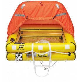
<h2>An offshore raft designed for extreme conditions</h2>
<p>We remind you that it is mandatory to navigate with a liferaft for any navigation exceeding 6 miles from a shelter. This ISO 9650-1 Transocean liferaft meets the required specifications set by Division 240 since May 1st 2015 of the "offshore" category.</p>
<p>Suitable for sailing in extreme conditions, it has a floating anchor, a double insulating bottom, the tent is positioned with an automatically adjustable ring and can be inflated to -15°. For added visibility and safety, the tent is fluorescent orange, with retro-reflective and radar-readable stripes and an external light on the raft.</p>
<p>The security armament is a <span>FULL armament including water and food (waiting for help estimated at - 24 hours). </span>For the revision of your raft, we take care of it, you will just have to bring it to us.</p>
<h2>Characteristics of the Transocean ISO 9650-1 deep-sea raft from Plastimo</h2>
</div>
available

-
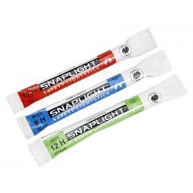
<h2><span>Colored light sticks to be visible</span></h2>
<p style="text-align:justify;"><span>These coloured sticks (blue, red and green) are visible for more than a mile</span><span> They are essential for the safety of each crew member sailing at night. </span><span>100% reliable %It is unbreakable, non-corrosive, waterproof, non-toxic, non-flammable, non-sparking and battery-free, and can be used in all circumstances: </span><span>Man overboard, gas leak, power failure, engine failure, in the wind, in or under water, anchor light or to signal...</span></p>
<h2>Characteristics of the light sticks</h2>
available

-
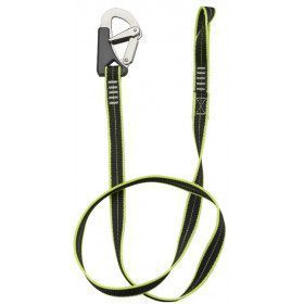
<h2>Single lanyards with 2 stainless steel carabiners with double safety and automatic closing</h2>
<p>Very flexible polyester lanyard with retroreflective thread for easy and quick night-time identification. Lanyard in webbing 23 mm wide and 1m long.</p>
<h2>Characteristics of the single lanyard with 2 carabiners</h2>
available

Showing 145-192 of 218 item(s)


